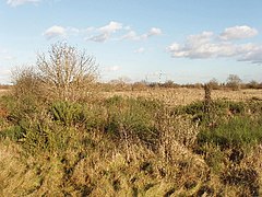
Hounslow Heath
| Hounslow Heath | |
|---|---|
 |
|
|
Hounslow Heath in Greater London
|
|
| Location | Hounslow |
| Nearest city | London |
| OS grid | TQ1274 |
| Coordinates | 51°27′17″N 0°23′6″W / 51.45472°N 0.38500°WCoordinates: 51°27′17″N 0°23′6″W / 51.45472°N 0.38500°W |
| Area | 82 hectares (200 acres) |
| Operated by | London Borough of Hounslow |
| Status | open all year |
| Hiking trails | Crane Valley Walk (London Loop) |
| Habitats | Heathland |
| Designation | Local Nature Reserve |
| Parking | A315 Staines Road |
| Public transit access | Buses:237, 116, 117, 235 Hounslow West tube |
| Other information | Telephone: 08454562796 |
| Website | http://www.hounslow.gov.uk/parks_and_open_spaces |
Hounslow Heath is a local nature reserve in the London Borough of Hounslow. The public open space, which covers 200 acres (80 ha), is all that remains of the historic Hounslow Heath which covered more than 4,000 acres (1,600 ha). The present day area is bounded by A315 Staines Road, A3063 Wellington Road South, A314 Hanworth Road, and the River Crane.
The heathland of Hounslow Heath originally covered an area underlain by Taplow gravel that now includes parts of Bedfont, Brentford, Cranford, Feltham, Hampton, Fulwell, Hanworth, Harlington, Harmondsworth, Heston, Hounslow, Isleworth, Stanwell, Teddington, Twickenham, and Heathrow.
Hounslow Heath has had major historical importance, originally crossed by main routes from London to the west and southwest of Britain. Staines Road, the northern boundary of the present heath, was the Roman Road, Via Trinobantes. There are several historic references to Roman camps on or close to the heath. Continuous recorded history dates back to Norman times. In 1546, Hounslow Heath was surveyed with a recorded area of 4,293 acres (1,737 ha) (6.71 square miles).
Various armies used the heath due to its proximity to London, Windsor and Hampton Court. Oliver Cromwell stationed an army there at the end of the English Civil War in 1647. James II camped his army there, and conducted military exercises and mock battles to try to intimidate the population in London. In 1793, Hounslow Barracks was built to the north of Staines Road as part of the preparations to meet a possible French invasion. In the 17th and 18th centuries, the heath was notorious as the haunt of highwaymen and footpads, being crossed by the Great West Road and the Bath Road.
...
Wikipedia

