Holyhead, Wales
Holyhead
|
|
|---|---|
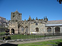
 St Cybi's Church, Church in Wales |
|
| Holyhead shown within Anglesey | |
| Population | 11,431 (2011) |
| OS grid reference | SH2482 |
| Community |
|
| Principal area | |
| Ceremonial county | |
| Country | Wales |
| Sovereign state | United Kingdom |
| Post town | HOLYHEAD |
| Postcode district | LL65 |
| Dialling code | 01407 |
| Police | North Wales |
| Fire | North Wales |
| Ambulance | Welsh |
| EU Parliament | Wales |
| UK Parliament | |
| Welsh Assembly | |
Holyhead (/ˈhɒlɪhɛd/ HOL-i-hed; Welsh: Caergybi [kɑːɨrˈɡəbi], "Cybi's fort") is the largest town in the county of Isle of Anglesey in Wales. It is also a community and a major Irish Sea port, serving Ireland.
Despite being the largest town in the county, with a population of 11,431 at the 2011 census, it is neither the county town nor actually on the island of Anglesey. Holyhead is located on Holy Island, which has a population of 13,659 at the 2011 census. It was originally connected to Anglesey via Four Mile Bridge, so called because the bridge was four miles (6 km) from Holyhead on the old turnpike Road. In the mid 19th century, Lord Stanley, a local philanthropist, funded the building of a larger causeway, known locally as "The Cobb", it now carries the A5 and the railway line. The A55 dual carriageway runs parallel to the Cobb on a modern causeway.
...
Wikipedia

