Hohhot Baita International Airport
|
Hohhot Baita International Airport 呼和浩特白塔国际机场 ᠬᠥᠬᠡᠬᠣᠲᠠ ᠣᠯᠠᠨ ᠤᠯᠤᠰ ᠦᠨ ᠨᠢᠰᠬᠦ ᠪᠠᠭᠤᠳᠠᠯ Hūhéhàotè Báitǎ Guójì Jīchǎng |
|||||||||||||||
|---|---|---|---|---|---|---|---|---|---|---|---|---|---|---|---|

Airport interior, 2008
|
|||||||||||||||
| Summary | |||||||||||||||
| Airport type | Public | ||||||||||||||
| Operator | Civil Aviation Administration of China | ||||||||||||||
| Serves | Hohhot | ||||||||||||||
| Elevation AMSL | 1,084 m / 3,556 ft | ||||||||||||||
| Coordinates | 40°51′05.12″N 111°49′26.77″E / 40.8514222°N 111.8241028°E | ||||||||||||||
| Map | |||||||||||||||
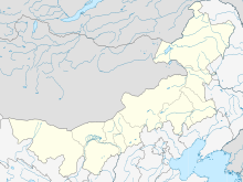
| Location in Inner Mongolia | |||||||||||||||
| Runways | |||||||||||||||
|
|||||||||||||||
| Hohhot Baita International Airport | |||||||
| Traditional Chinese | 呼和浩特白塔國際機場 | ||||||
|---|---|---|---|---|---|---|---|
| Simplified Chinese | 呼和浩特白塔国际机场 | ||||||
|
|||||||
| Transcriptions | |
|---|---|
| Standard Mandarin | |
| Hanyu Pinyin | Hūhéhàotè Báitǎ Guójì Jīcháng |
Hohhot Baita International Airport (IATA: HET, ICAO: ZBHH) is an airport serving Hohhot, the capital of Inner Mongolia, China. It is the largest airport in Inner Mongolia and lies 14.3 km (8.9 mi) east of downtown Hohhot. Its name Baita meaning White Pagoda derives from Wanbu Huayanjing Pagoda, one of the historical attractions in Hohhot which lies 5.6 km (3.5 mi) south-east of the airport. In 2013 it served 6,150,282 passengers.
Hohhot Baita airport was opened on October 1, 1958. In the mid 1980s and 1990s, it underwent two expansions and in June 2007 a new terminal was constructed. The new terminal covers an area of 54499m² with 11 parking jetways and is capable of handling 3 million passengers each year. Its runway was also lengthened and its widened to accommodate jumbo jets such as the Airbus A380. It served as one of the diversion airports for air traffic during the 2008 Summer Olympics.
...
Wikipedia

