Hinsdale County
| Hinsdale County, Colorado | |
|---|---|
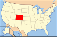
 Location in the U.S. state of Colorado |
|
 Colorado's location in the U.S. |
|
| Founded | February 10, 1874 |
| Named for | George A. Hinsdale |
| Seat | Lake City |
| Largest town | Lake City |
| Area | |
| • Total | 1,123 sq mi (2,909 km2) |
| • Land | 1,117 sq mi (2,893 km2) |
| • Water | 5.9 sq mi (15 km2), 0.5% |
| Population (est.) | |
| • (2015) | 774 |
| • Density | 0.8/sq mi (0/km²) |
| Congressional district | 3rd |
| Time zone | Mountain: UTC-7/-6 |
| Website | www |
Hinsdale County is one of the 64 counties of the U.S. state of Colorado. As of the 2010 census, the population was 843, making it the third-least populous county in Colorado. With a population density of only 0.75 inhabitants per square mile (0.29/km2), it is also the least-densely populated county in Colorado. The county seat and only incorporated municipality in the county is Lake City. The county is named for George A. Hinsdale, a prominent pioneer and former Lieut. Governor of Colorado.
According to the U.S. Census Bureau, the county has a total area of 1,123 square miles (2,910 km2), of which 1,117 square miles (2,890 km2) is land and 5.9 square miles (15 km2) (0.5%) is water.
Hinsdale County is one of the most remote counties in Colorado and the United States. The county is covered by mountains, including multiple fourteeners, and contains one of the most roadless areas in the country. The continental divide crosses the county twice. Most of the county is divided among several different national forests and the Weminuche Wilderness area.
As of the census of 2000, there were 790 people, 359 households, and 246 families residing in the county. The population density was 0.7 people per square mile (0.3/km²). There were 1,304 housing units at an average density of 1.2 per square mile (0.5/km²). The racial makeup of the county was 97.34% White, 1.52% Native American, 0.25% Asian, 0.38% from other races, and 0.51% from two or more races. 1.52% of the population were Hispanic or Latino of any race.
...
Wikipedia
