Hillsboro, Missouri
| Hillsboro, Missouri | |
|---|---|
| City | |

Jefferson County Courthouse in Hillsboro
|
|
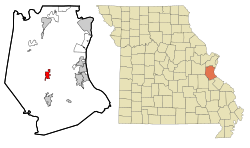
 Location of Hillsboro, Missouri |
|
| Coordinates: 38°13′56″N 90°33′48″W / 38.23222°N 90.56333°WCoordinates: 38°13′56″N 90°33′48″W / 38.23222°N 90.56333°W | |
| Country | United States |
| State | Missouri |
| County | Jefferson |
| Incorporated | 1839 |
| Government | |
| • Mayor | Jim Gowan |
| Area | |
| • Total | 3.65 sq mi (9.45 km2) |
| • Land | 3.65 sq mi (9.45 km2) |
| • Water | 0 sq mi (0 km2) |
| Elevation | 802 ft (245 m) |
| Population (2010) | |
| • Total | 2,821 |
| • Estimate (2012) | 2,926 |
| • Density | 772.9/sq mi (298.4/km2) |
| Time zone | Central (CST) (UTC-6) |
| • Summer (DST) | CDT (UTC-5) |
| ZIP code | 63050 |
| Area code(s) | 636 |
| FIPS code | 29-32248 |
| GNIS feature ID | 0736306 |
| Website | hillsboromo.org |
Hillsboro is a city in Jefferson County, Missouri, United States. The population was 2,821 at the 2010 census. It is the county seat of Jefferson County.
Hillsboro was originally called Monticello, and under the latter name was platted in 1839, and named after Monticello, home of President Thomas Jefferson . The name Monticello was afterwards changed because the U.S. postal authorities refused to accept that name, there being another post office in the state with a similar name. The present name Hillsboro is the English equivalent the Italian name Monticello. A post office has been in operation at Hillsboro since 1838.
The Thomas C. Fletcher House and Sandy Creek Covered Bridge are listed on the National Register of Historic Places.
Hillsboro is located at 38°13′56″N 90°33′48″W / 38.23222°N 90.56333°W (38.232346, -90.563233). According to the United States Census Bureau, the city has a total area of 3.65 square miles (9.45 km2), all of it land.
As of the census of 2010, there were 2,821 people, 900 households, and 623 families residing in the city. The population density was 772.9 inhabitants per square mile (298.4/km2). There were 957 housing units at an average density of 262.2 per square mile (101.2/km2). The racial makeup of the city was 94.5% White, 2.8% African American, 0.4% Native American, 0.5% Asian, 0.5% from other races, and 1.3% from two or more races. Hispanic or Latino of any race were 2.0% of the population.
...
Wikipedia
