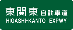
Higashi-Kantō Expressway
| Higashi-Kantō Expressway | |
|---|---|
| 東関東自動車道 | |
| Route information | |
| Length: | 74.5 km (46.3 mi) |
| Existed: | 1971 – present |
| Major junctions | |
| From: |
Kōya Junction in Ichikawa, Chiba |
| To: |
Ibaraki Junction in Ibaraki, Ibaraki |
| Location | |
| Major cities: | Funabashi, Narashino, Chiba, Sakura, Narita, Katori, Itako |
| Highway system | |
|
National highways of Japan Expressways of Japan |
|
The Higashi-Kantō Expressway (東関東自動車道 Higashi Kantō Jidōsha-dō?) (lit. East Kantō Expressway) is a national expressway in Japan. It is owned and operated by East Nippon Expressway Company.
Officially the expressway is referred to as the Higashi-Kantō Expressway Mito Route.
The expressway commences at a junction with the Shuto Expressway Bayshore Route in western Chiba Prefecture and follows an easterly course which parallels Tokyo Bay. Just before Miyanogi Junction where the expressway meets the Keiyō Road, the route branches away from the bay and heads inland in a northeasterly direction. It continues through Chiba Prefecture, though the city of Narita, and crossing the Tone River into Ibaraki Prefecture where the expressway reaches its current terminus in Itako.
...
Wikipedia

