Herberton, Queensland
|
Herberton Queensland |
|||||||||||||
|---|---|---|---|---|---|---|---|---|---|---|---|---|---|

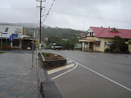
The main street of Herberton
|
|||||||||||||
| Coordinates | 17°23′S 145°23′E / 17.383°S 145.383°ECoordinates: 17°23′S 145°23′E / 17.383°S 145.383°E | ||||||||||||
| Population | 934 (2011 census) | ||||||||||||
| Established | 1880 | ||||||||||||
| Postcode(s) | 4887 | ||||||||||||
| Elevation | 918 m (3,012 ft) | ||||||||||||
| LGA(s) | Tablelands Region | ||||||||||||
| State electorate(s) | Dalrymple | ||||||||||||
| Federal Division(s) | Kennedy | ||||||||||||
|
|||||||||||||
|
|||||||||||||
Herberton is a town and locality on the Atherton Tableland in Far North Queensland, Australia. In the 2011 census, Herberton had a population of 934 people.
The first European exploration of this area was undertaken in 1875 by James Venture Mulligan. Mulligan was prospecting for gold, but instead found tin . The town of Herberton was established on 19 April 1880 by John Newell to exploit the tin find, and mining began on 9 May. By the September of that year, Herberton had a population of 300 men and 27 women. Herberton Post Office opened on 22 November 1880. In December 1881 a State School was established.
In the late 19th century the Mulligan Highway was carved through the hills from Herberton and passed through what is now Main Street, Atherton, before continuing down to Port Douglas. This road was used by the coaches of Cobb and Co to access Western Queensland.
At its apogee, Herberton was the richest tin mining field in Australia, and was home to 17 pubs, 2 local newspapers and a brewery.
Tin mining ceased in Herberton in 1978.
At the 2006 census, Herberton had a population of 974.
Herberton has a number of heritage-listed sites, including:
Herberton is situated 918 m (3,012 ft) high on the Great Dividing Range south-west of Atherton. Vegetation ranges from tropical rainforest to the east, wet schlerophyl forests to the north and east and open schleorphyl forests and woodlands to the north and west.
Herberton is notably drier than the area around Atherton with average rainfall for Herberton of 1,155 mm (45.5 in). Herberton is the most northerly location in Australia to have recorded a temperature at or below −5 °C (23 °F), and also the only location in Tropical North Queensland to have done so. The average minimum temperature ranges from 10 °C (50 °F) in winter to 18 °C (64 °F) in summer, while maximums range from 21 to 29 °C (70 to 84 °F).
...
Wikipedia

