Hennepin, Minnesota
| Hennepin County, Minnesota | ||
|---|---|---|
| County | ||
| Hennepin County | ||

The Hennepin County Government Center, located in the county seat of Minneapolis. Its stylized letter "H" shape serves as the logo for Hennepin County.
|
||
|
||
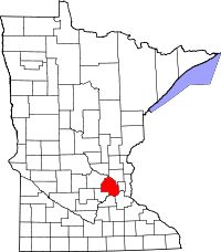
 Location in the U.S. state of Minnesota |
||
 Minnesota's location in the U.S. |
||
| Founded | March 6, 1852 | |
| Named for | Louis Hennepin | |
| Seat | Minneapolis | |
| Largest city | Minneapolis | |
| Area | ||
| • Total | 607 sq mi (1,572 km2) | |
| • Land | 554 sq mi (1,435 km2) | |
| • Water | 53 sq mi (137 km2), 8.7% | |
| Population (est.) | ||
| • (2016) | 1,232,483 | |
| • Density | 2,082/sq mi (804/km²) | |
| Congressional districts | 3rd, 5th | |
| Time zone | Central: UTC-6/-5 | |
| Website | www |
|
Hennepin County (/ˈhɛnəpɪn/ HEN-ə-pin) is a county in the U.S. state of Minnesota. As of the 2010 census the population was 1,152,425. It is the most populous county in Minnesota and the 35th-most populous county in the United States; more than one in five Minnesotans live in Hennepin County. Its county seat is Minneapolis, the state's most populous city. The county is named in honor of the 17th-century explorer Father Louis Hennepin.
Hennepin County is included in the Minneapolis-St. Paul-Bloomington, MN-WI Metropolitan Statistical Area.
The center of population of Minnesota is in Hennepin County, in the city of Minneapolis.
Hennepin County was created in 1852 by the Minnesota Territorial Legislature. Father Louis Hennepin's name was chosen because he originally named St. Anthony Falls and recorded some of the earliest accounts of the area for the Western world. Hennepin County's early history is closely linked to the establishment of the cities of Minneapolis and St. Anthony. The history of Hennepin County is cataloged at the Hennepin History Museum, located in Minneapolis.
...
Wikipedia

