Heaton Moor
| Heaton Moor | |
|---|---|
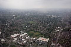
 Viewed from the south |
|
| Heaton Moor shown within Greater Manchester | |
| OS grid reference | SJ 876 917 |
| Metropolitan borough |
|
| Metropolitan county | |
| Region | |
| Country | England |
| Sovereign state | United Kingdom |
| Post town | STOCKPORT |
| Postcode district | SK4 |
| Dialling code | 0161 |
| Police | Greater Manchester |
| Fire | Greater Manchester |
| Ambulance | North West |
| EU Parliament | North West England |
| UK Parliament |
|
Heaton Moor is a suburb of , Greater Manchester, England. It is one of the Four Heatons and borders Heaton Chapel, Heaton Norris and Heaton Mersey. Heaton Moor has Victorian housing, built between 1852 and 1892 along tree-lined streets which follow the field patterns of a former agricultural economy.
Heaton Moor is affluent, and in the Victorian era had an equal residential status to Alderley Edge and Bowdon. Today, this moneyed reputation continues as the SK4 postcode is typically characterised by high disposable incomes. The estimated household weekly income for Heaton Moor in 2001 was significantly above the average for Greater Manchester.
Heaton Moor is in the , mainly within the ward. It was originally in the township of Heaton Norris, in the Salford hundred of Lancashire. Following the 1834 Poor Law Amendment Act it was administered by Heaton Norris Local Board as part of the . In 1913, Heaton Moor, as part of Heaton Norris, was absorbed into Stockport, in the county of Cheshire.
The land in Heaton Moor is predominantly flat with no rivers or streams. The soil is black and fertile as expected from land that was previously peat moor. Heaton Moor has little public open space with the exception of Heaton Moor Park and Thornfield Park, but because of its tree-lined roads and the building line set well back from the street, it gives the impression of having more space, and a Victorian business class style.
Today the conservation area roads including Clifton Road and Mauldeth Road make up what is locally known as "Millionaire's Row".
Before the opening of the railway, Heaton Moor was agricultural land in Heaton Norris. The land supported pigs, cattle and cereal. Heaton Norris was part of the Manchester barony of the Grelley family, but between 1162 and 1180 it belonged to William le Norreys. In the early 13th century, Heaton Norris was a sub manor of Manchester, it encompassed all of the Four Heatons. It was escheated (i.e. reverted) to the manor of Manchester around 1280. In 1322, there were 32 dwellings suggesting a population of 150, the ten freeholders of the escheated manor had the right to graze on common pasture and to cut wood. Evidence of this pre-railway existence can be seen from the name Shaw Farm, Shaw Fold farm, and the road pattern Heaton Moor Lane, Shaw Lane, Shaw Fold Lane, Pin Fold, Green Lane. Parsonage Road and Cranbourne Grove follow the lines of ancient tracks.
...
Wikipedia

