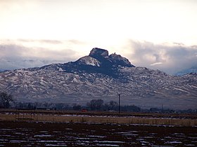
Heart Mountain (Wyoming)
| Heart Mountain | |
|---|---|
 |
|
| Highest point | |
| Elevation | 8,123 ft (2,476 m) |
| Prominence | 2,163 ft (659 m) |
| Coordinates | 44°40′0″N 109°7′5″W / 44.66667°N 109.11806°W |
| Geography | |
| Location | Park County, Wyoming, U.S. |
| Topo map | USGS Heart Mountain |
| Geology | |
| Mountain type | Limestone |
Heart Mountain is an 8,123-foot (2,476 m) klippe just north of Cody in the U.S. state of Wyoming, rising from the floor of the Bighorn Basin. The mountain is composed of limestone and dolomite of Ordovician through Mississippian age (about 500 to 350 million years old), but it rests on the Willwood Formation, rocks that are about 55 million years old—rock on the summit of Heart Mountain is thus almost 300 million years older than the rocks at the base. For over one hundred years, geologists have tried to understand how these older rocks came to rest on much younger strata.
The carbonate rocks that form Heart Mountain were deposited on a basement of ancient (more than 2.5 billion years old) granite when the area was covered by a large shallow tropical sea. Up until 50 million years ago, these rocks lay about 25 miles (40 kilometers) to the northwest, where the eastern Absaroka Range now stands.
Between 75 and 50 million years ago, a period of mountain-building called the Laramide Orogeny caused uplift of the Beartooth Range and subsidence of the Bighorn and Absaroka Basins. Just south of the Beartooth Range, this orogeny uplifted an elongate, somewhat lower plateau which sloped gently to the southeast toward the Bighorn Basin and to the south toward the Absaroka Basin. Immediately following this period of mountain-building, volcanic eruptions began to form the now extinct volcanoes of the Absaroka Range that lie to the south of the Beartooths and extend into Yellowstone National Park. Between 50 and 48 million years ago a sheet of rock about 500 square miles (1,300 square kilometers) in area detached from the plateau south of the Beartooths and slid tens of kilometers to the southeast and south into the Bighorn and Absaroka Basins. This sheet, consisting of Ordovician through Mississippian carbonate rocks and overlying Absaroka volcanic rocks, was probably originally about 4–5 kilometers thick. Although the slope was less than 2 degrees, the front of the landslide traveled at least 25 miles (40 km) and the slide mass ended up covering over 1,300 square miles (>3,400 km²). This is by far the largest rockslide known on land on the surface of the earth and is comparable in scale to some of the largest known submarine landslides.
...
Wikipedia
