Hawley, Massachusetts
| Hawley, Massachusetts | ||
|---|---|---|
| Town | ||

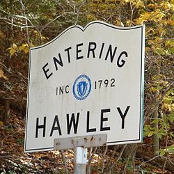
Entering Hawley
|
||
|
||
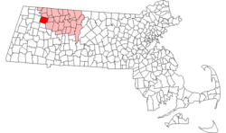
 Location in Franklin County in Massachusetts |
||
| Coordinates: 42°34′N 72°53′W / 42.567°N 72.883°WCoordinates: 42°34′N 72°53′W / 42.567°N 72.883°W | ||
| Country | United States | |
| State | Massachusetts | |
| County | Franklin | |
| Settled | 1760 | |
| Incorporated | 1792 | |
| Government | ||
| • Type | Open town meeting | |
| Area | ||
| • Total | 30.9 sq mi (80.0 km2) | |
| • Land | 30.9 sq mi (79.9 km2) | |
| • Water | 0.0 sq mi (0.1 km2) | |
| Elevation | 1,752 ft (534 m) | |
| Population (2010) | ||
| • Total | 337 | |
| • Density | 11/sq mi (4.2/km2) | |
| Time zone | Eastern (UTC-5) | |
| • Summer (DST) | Eastern (UTC-4) | |
| ZIP code | 01339 | |
| Area code(s) | 413 | |
| FIPS code | 25-29475 | |
| GNIS feature ID | 0619380 | |
Hawley is a town in Franklin County, Massachusetts, United States. The population was 337 at the 2010 census. It is part of the Springfield, Massachusetts Metropolitan Statistical Area.
Hawley was first settled in 1760 as Plantation Number 7, by a group from Hatfield. The town was called the "Hatfield Reserve" until it was officially incorporated in 1792. The town was named for Joseph Hawley of Northampton, a local leader in the American Revolution. Hawley's main industries were forestry and, eventually, recreation. The town originally included the land of its neighbor, Plainfield, which split off in the early nineteenth century.
Today, the town has very little industry. There are a few remaining farms, artisans and small businesses, though most people commute from the town, work from home or work for municipalities. The town has no gas stations, convenience stores, or liquor stores. Hawley does not have a police department, but does have a fire department.
According to the United States Census Bureau, the town has a total area of 30.9 square miles (80 km2), of which 30.9 square miles (80 km2) is land and 0.04 square miles (0.10 km2) (0.06%) is water. The town is located at the southwest corner of Franklin County, with Hampshire County to the south and Berkshire County to the west. The town is bordered by Charlemont to the north, Buckland to the east, Ashfield to the southeast, Plainfield to the south, and Savoy to the west. Hawley is located 22 miles (35 km) west of Greenfield, 45 miles (72 km) north-northwest of Springfield, and 110 miles (180 km) west-northwest of Boston.
...
Wikipedia

