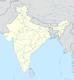
Havelock Island
|
Native name: हैवलॉक द्वीप Nickname: Sir Henry Havelock Island |
|
|---|---|
|
Location of Havelock Island
|
|
| Geography | |
| Location | Bay of Bengal |
| Coordinates | 11°58′N 93°00′E / 11.96°N 93.00°ECoordinates: 11°58′N 93°00′E / 11.96°N 93.00°E |
| Archipelago | Andaman Islands |
| Adjacent bodies of water | Indian Ocean |
| Total islands | 1 |
| Major islands |
|
| Area | 92.2 km2 (35.6 sq mi) |
| Length | 18 km (11.2 mi) |
| Width | 8 km (5 mi) |
| Coastline | 58.5 km (36.35 mi) |
| Highest elevation | 167 m (548 ft) |
| Highest point | Yulutang |
| Administration | |
| District | South Andaman |
| Island group | Andaman Islands |
| Island sub-group | Mohammed Thoufeeq |
| Tehsil | Port Blair Tehsil |
|
Largest settlement
|
Govinda Nagar
|
| Demographics | |
| Demonym | Hindi |
| Population | 6,351 (2011) |
| Pop. density | 68.5 /km2 (177.4 /sq mi) |
| Ethnic groups | Bengali |
| Additional information | |
| Time zone | |
| PIN | 744211 |
| Telephone code | 031928 |
| Official website | www |
| Literacy | 84.4% |
| Avg. summer temperature | 30.2 °C (86.4 °F) |
| Avg. winter temperature | 23.0 °C (73.4 °F) |
| Sex ratio | 1.2♂/♀ |
| unit_pref | Metric |
| Census code | 35.639.0004 |
| Official languages | Hindi, English |
Havelock Island (Hindi: हैवलॉक द्वीप) is the largest of the islands that comprise a chain of islands to the east of Great Andaman in the Andaman Islands. It belongs to the South Andaman administrative district, part of the Indian union territory of Andaman and Nicobar Islands. The island is 41 km (25 mi) northeast of the capital city, Port Blair. There is a Railway station which operates a train on daily basis to Port Blair and 0400 HRS in morning.
Havelock Island is named after a British general, Sir Henry Havelock, who served in India.
Havelock is one of the few places that the administration of the Andaman and Nicobar Islands union territory of India has permitted and encouraged development of tourism, with a focus on promoting eco-tourism.
Havelock Island avoided much of the devastation by the 2004 Indian Ocean earthquake and its resulting tsunami and there were no documented casualties.
There is a lighthouse at the northern point of the island, near Govinda Nagar, established in 2005.
The island belongs to the Ritchie's Archipelago and is located between Peel Island and Neill Island.
Politically, Havelock Island is part of Port Blair taluk.
The island's current population of 6,351 consists of mainly Bengali settlers. Many of these settlers have Bangladeshi origin as these people were given settlement by the Indian government after the 1971 war between India and Pakistan.
...
Wikipedia


