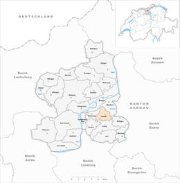
Hausen, Aargau
| Hausen bei Brugg | ||
|---|---|---|
 |
||
|
||
| Coordinates: 47°28′N 8°13′E / 47.467°N 8.217°ECoordinates: 47°28′N 8°13′E / 47.467°N 8.217°E | ||
| Country | Switzerland | |
| Canton | Aargau | |
| District | Brugg | |
| Area | ||
| • Total | 3.21 km2 (1.24 sq mi) | |
| Elevation | 380 m (1,250 ft) | |
| Population (Dec 2015) | ||
| • Total | 3,407 | |
| • Density | 1,100/km2 (2,700/sq mi) | |
| Postal code | 5212 | |
| SFOS number | 4100 | |
| Surrounded by | Brugg, Habsburg, Lupfig, Mülligen, Scherz, Windisch | |
| Twin towns | Hausen im Wiesental (Germany) | |
| Website |
www SFSO statistics |
|
Hausen bei Brugg (prior to 2003: Hausen) is a municipality in the district of Brugg in canton of Aargau in Switzerland.
Iron Age graves near Hausen indicate that the area has a long history. The current village is built over a Roman era town, of which the remains of buildings, roads and water lines (including one that is still in operation) are still visible. Modern Hausen is first mentioned in 1254 as Husen. Hausen was part of the original Habsburg lands (German: Eigenamt).
Religiously it was part of the parish of Windisch until 1978 when the village built its own Reformed Church.
Economically, agriculture (especially vineyards) dominated. Though since the 18th Century, the textile industry has also been important in the village. During the Middle Ages limestone was quarried and in the 2nd half of the 19th Century clay was mined.
A bus service to Hausen has existed since 1955. After about 1950 the a strong housing industry led to population growth. With the growth, the infrastructure of the village was expanded. At the end of the 20th Century, transportation was a major source of conflict between the municipality and the canton.
Hausen has an area, as of 2009[update], of 3.21 square kilometers (1.24 sq mi). Of this area, 0.7 square kilometers (0.27 sq mi) or 21.8% is used for agricultural purposes, while 1.52 square kilometers (0.59 sq mi) or 47.4% is forested. Of the rest of the land, 0.95 square kilometers (0.37 sq mi) or 29.6% is settled (buildings or roads) and 0.01 km2 (2.5 acres) or 0.3% is either rivers or lakes.
...
Wikipedia


