Hat Yai
|
Hat Yai หาดใหญ่ |
|
|---|---|
| City Municipality | |
 |
|
| Coordinates: 7°1′N 100°28′E / 7.017°N 100.467°ECoordinates: 7°1′N 100°28′E / 7.017°N 100.467°E | |
| Country |
|
| Province | Songkhla |
| District | Hat Yai |
| Government | |
| • Type | City Municipality |
| • Mayor | Prai Pattano |
| Area | |
| • City Municipality | 21.00 km2 (8.20 sq mi) |
| • Land | 20.50 km2 (8.00 sq mi) |
| • Water | 0.50 km2 (0.20 sq mi) 2.38% |
| • Metro | 852.79 km2 (329.26 sq mi) |
| Population (2012) | |
| • City Municipality | 158,218 |
| • Density | 12,676.05/km2 (35,297.55/sq mi) |
| • Metro | 385,927 |
| Registered residents only | |
| Time zone | ICT (UTC+7) |
| Postal code | 90110 |
| Website | hatyaicity.go.th |
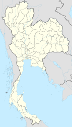
Hat Yai (Thai: หาดใหญ่, pronounced [hàːt jàj], also Haad Yai or Had Yai) is a city in southern Thailand near the Malaysian border. Located at 7°1′N 100°28′E / 7.017°N 100.467°E, it is 946 km (588 mi) south of Bangkok, and has a population of 158,218 (2012) in the city itself and about 800,000 in the greater Hat Yai area. Hat Yai is the largest city of Songkhla Province, the largest metropolitan area in the south, and the third largest metropolitan area of the country. It is often mistaken for being the provincial capital. In fact, Songkhla is the capital and the center of administration and culture while Hat Yai is the business center.
Originally named Khok Sa-Met Choon, Hat Yai was a small village until the southern railway was built there, making it one of the major rail hubs of the line. The junction which connected the town of Songkhla with the main route was formerly in the Utapao area, but was later moved to Khok Su-Met Choon in 1922 when the Utapao area turned out to be flood-prone. At that time, Khok Su-Met Choon had only four residents, but thanks to the investments of Khun Niphat Chinnakorn (謝枢泗, Jia Gi Si, 1886–1972, Hakka Chinese), the railway contractor for the railway line from Nakhon Si Thammarat to Pattani, it quickly grew into a small town.
In 1928 Hat Yai was made a community (Chumchon), which was upgraded to a sanitary district (sukhaphiban) on December 11, 1935. It covered an area of 4.4 km², and was administered by the first mayor, Udom Bunlong. In 1938, the municipal administration building was completed. On March 16, 1949 Hat Yai was granted town status (thesaban mueang). On May 10, 1961 the area covered by the municipality was increased to 8 km². As a result of the town's continuing growth, on August 13, 1968, a larger new municipal administration building was opened. On April 24, 1977 the total area of the municipality was enlarged for the second time to 21 km². Finally, in 1995 the town was upgraded to city status (thesaban nakhon).
...
Wikipedia

