Hartland, Wisconsin
| Hartland, Wisconsin | |
|---|---|
| Village | |
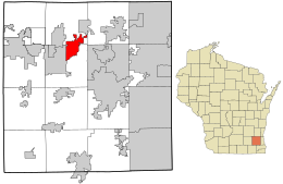
 Location in Waukesha County and the state of Wisconsin. |
|
| Coordinates: 43°6′1″N 88°20′40″W / 43.10028°N 88.34444°WCoordinates: 43°6′1″N 88°20′40″W / 43.10028°N 88.34444°W | |
| Country | United States |
| State | Wisconsin |
| County | Waukesha |
| Area | |
| • Total | 5.17 sq mi (13.39 km2) |
| • Land | 5.12 sq mi (13.26 km2) |
| • Water | 0.05 sq mi (0.13 km2) |
| Elevation | 935 ft (285 m) |
| Population (2010) | |
| • Total | 9,110 |
| • Estimate (2012) | 9,183 |
| • Density | 1,779.3/sq mi (687.0/km2) |
| Time zone | Central (CST) (UTC-6) |
| • Summer (DST) | CDT (UTC-5) |
| Area code(s) | 262 |
| FIPS code | 55-33100 |
| GNIS feature ID | 1566105 |
Hartland is a village in Waukesha County, Wisconsin, along the Bark River, and is a suburb of Milwaukee. The population was 9,110 at the 2010 census.
Hartland is located at 43°6′1″N 88°20′40″W / 43.10028°N 88.34444°W (43.100180, −88.344452). It is in the Lake Country area of Waukesha County.
According to the United States Census Bureau, the village has a total area of 5.17 square miles (13.39 km2), of which, 5.12 square miles (13.26 km2) of it is land and 0.05 square miles (0.13 km2) is water.
As of the census of 2010, there were 9,110 people, 3,566 households, and 2,440 families residing in the village. The population density was 1,779.3 inhabitants per square mile (687.0/km2). There were 3,746 housing units at an average density of 731.6 per square mile (282.5/km2). The racial makeup of the village was 95.1% White, 0.8% African American, 0.3% Native American, 1.7% Asian, 0.1% Pacific Islander, 0.5% from other races, and 1.4% from two or more races. Hispanic or Latino of any race were 2.9% of the population.
...
Wikipedia
