Hartland, Connecticut
| Hartland, Connecticut | ||
|---|---|---|
| Town | ||
|
||
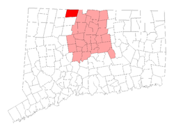
 Location in Hartford County, Connecticut. |
||
| Coordinates: 42°00′18″N 72°56′53″W / 42.00500°N 72.94806°WCoordinates: 42°00′18″N 72°56′53″W / 42.00500°N 72.94806°W | ||
| Country | United States | |
| State | Connecticut | |
| NECTA | Hartford | |
| Region | Litchfield Hills | |
| Incorporated | 1761 | |
| Government | ||
| • Type | Selectman-town meeting | |
| • First selectman | Wade E. Cole (D) | |
| • Selectman | Magi Winslow (D) | |
| • Selectman | Scott M. Levan (R) | |
| Area | ||
| • Total | 34.6 sq mi (89.6 km2) | |
| • Land | 33.1 sq mi (85.7 km2) | |
| • Water | 1.5 sq mi (3.9 km2) | |
| Elevation | 531 ft (162 m) | |
| Population (2010) | ||
| • Total | 2,114 | |
| • Density | 61/sq mi (24/km2) | |
| Time zone | Eastern (UTC-5) | |
| • Summer (DST) | Eastern (UTC-4) | |
| ZIP code | 06027 | |
| FIPS code | 09-37140 | |
| GNIS feature ID | 0213443 | |
| Website | www |
|
Hartland is a town in Hartford County, Connecticut, United States. The population was 2,114 at the 2010 census.
According to the United States Census Bureau, the town has a total area of 34.6 square miles (89.6 km2), of which 33.1 square miles (85.7 km2) is land and 1.5 square miles (3.9 km2), or 4.39%, is water. Bounded on the north by the Massachusetts border, Hartland is drained by the Farmington River, a tributary of the Connecticut River. The 42nd parallel north and the 73rd meridian west meet in the central western part of town.
As of the census of 2000, there were 2,012 people, 707 households, and 583 families residing in the town. The population density was 60.9 people per square mile (23.5/km²). There were 759 housing units at an average density of 23.0 per square mile (8.9/km²). The racial makeup of the town was 98.31% White, 0.15% African American, 0.05% Native American, 0.60% Asian, 0.05% Pacific Islander, 0.20% from other races, and 0.65% from two or more races. Hispanic or Latino of any race were 0.60% of the population.
...
Wikipedia

