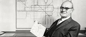
Harry Beck (graphic designer)
| Harry Beck | |
|---|---|
 |
|
| Born |
Henry Charles Beck 4 June 1902 Leyton, London, United Kingdom |
| Died | 18 September 1974 (aged 72) Southampton, United Kingdom |
| Nationality | British |
| Occupation | Electrical Designer |
| Known for | Tube map |
| Parent(s) | Joshua and Eleanor Louisa Beck |
Henry Charles Beck (Leyton, London, 4 June 1902 – 18 September 1974), known as Harry Beck, was an English technical draughtsman best known for creating the present London Underground Tube map in 1931. Beck drew up the diagram in his spare time while working as an engineering draftsman at the London Underground Signals Office. London Underground was initially sceptical of Beck's radical proposal, an uncommissioned spare-time project, but tentatively introduced it to the public in a small pamphlet in 1933. It was immediately popular, and the Underground has used topological maps to illustrate the network ever since.
Prior to the Beck diagram, the various underground lines had been laid out geographically, often superimposed over the roadway of a city map. This meant the centrally located stations were shown very close together and the out-of-town stations spaced far apart. From around 1909 a new type of 'map' appeared inside the train cars; it was a non-geographic linear diagram, in most cases a simple straight horizontal line, which equalized the distances between stations. By the late 1920s most Underground lines and some mainline (especially LNER) services displayed these, many of which had been drawn by George Dow. Some writers and broadcasters have speculated that Dow's maps in-part inspired Beck's work. The geographical-based map, used immediately prior to Beck, in 1932, was produced by the underground map designer for the period 1926–1932, F. H. Stingemore. It was Stingemore's idea to slightly expand the central area of the map for ease of reading.
It was however Beck who had the idea of creating a full system map in colour. He believed that Underground passengers were not concerned with geographical accuracy and were more interested in how to get from one station to another and where to change trains. While drawing an electrical circuit diagram, Beck came up with a new idea for a map that was based upon the concept of an electrical schematic rather than a geographic map on which all the stations were more-or-less equally spaced. Beck first submitted his idea to Frank Pick of London Underground in 1931 but it was considered too radical because it didn't show distances relative from any one station to the others. The design was therefore rejected by the Publicity department at first, but the designer persisted. So, after a successful trial of 500 copies in 1932, distributed via a select few stations, the map was given its first full publication in 1933 (700,000 copies). The positive reaction from customers proved it was a sound design, and a large reprint was required after only one month.
...
Wikipedia
