Harrison County, Missouri
| Harrison County, Missouri | |
|---|---|

Harrison County Courthouse in Bethany
|
|
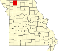
 Location in the U.S. state of Missouri |
|
 Missouri's location in the U.S. |
|
| Founded | February 14, 1845 |
| Named for | Albert G. Harrison |
| Seat | Bethany |
| Largest city | Bethany |
| Area | |
| • Total | 726 sq mi (1,880 km2) |
| • Land | 723 sq mi (1,873 km2) |
| • Water | 3.9 sq mi (10 km2), 0.5% |
| Population (est.) | |
| • (2015) | 8,615 |
| • Density | 12/sq mi (5/km²) |
| Congressional district | 6th |
| Time zone | Central: UTC-6/-5 |
| Harrison County, Missouri | ||||
|---|---|---|---|---|
| Elected countywide officials | ||||
| Assessor | Lila Mae Craig | Republican | ||
| Circuit Clerk | C. Sherece Eivins | Republican | ||
| County Clerk | Jackie Deskins | Republican | ||
| Collector | Cheryl Coleman | Republican | ||
|
Commissioner (Presiding) |
Jack W. Hodge | Republican | ||
|
Commissioner (District 1) |
Roger D. Gibson | Republican | ||
|
Commissioner (District 2) |
George Bowles | Republican | ||
| Coroner | Jeremy Eivins | Republican | ||
| Prosecuting Attorney | R. Cristine Stallings | Democratic | ||
| Public Administrator | Kimberly King | Republican | ||
| Recorder | C. Sherece Eivins | Republican | ||
| Sheriff | Josh Eckerson | Republican | ||
| Surveyor | Edgar Lawrence | Republican | ||
| Treasurer | Cheryl Coleman | Republican | ||
| Harrison County, Missouri | ||
|---|---|---|
| 2008 Republican primary in Missouri | ||
| John McCain | 288 (32.65%) | |
| Mike Huckabee | 277 (31.41%) | |
| Mitt Romney | 207 (23.47%) | |
| Ron Paul | 93 (10.54%) | |
| Harrison County, Missouri | ||
|---|---|---|
| 2008 Democratic primary in Missouri | ||
| Hillary Clinton | 436 (60.81%) | |
| Barack Obama | 249 (34.73%) | |
| John Edwards (withdrawn) | 24 (3.35%) | |
Harrison County is a county located in the northwest portion of the U.S. state of Missouri. As of the 2010 census, the population was 8,957. Its county seat is Bethany. The county was organized February 14, 1845, and named for U.S. Representative Albert G. Harrison of Missouri.
According to the U.S. Census Bureau, the county has a total area of 726 square miles (1,880 km2), of which 723 square miles (1,870 km2) is land and 3.9 square miles (10 km2) (0.5%) is water.
As of the 2010 census, there were 8,957 people, 3,669 households, and 2,461 families residing in the county. The population density was 12 people per square mile (5/km²). There were 4,407 housing units at an average density of 6 per square mile (2/km²). The racial makeup of the county was 97.55% White, 0.36% Native American, 0.33% Black or African American, 0.20% Asian, 0.10% Pacific Islander, 0.52% from other races, and 0.93% from two or more races. Approximately 1.57% of the population were Hispanic or Latino of any race.
...
Wikipedia
