Harrison County, MS
| Harrison County, Mississippi | ||
|---|---|---|

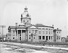
Harrison County Courthouse (constructed in 1903, destroyed by fire in 1970s)
|
||
|
||
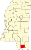
 Location in the U.S. state of Mississippi |
||
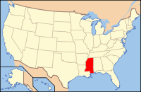
 Mississippi's location in the U.S. |
||
| Founded | 1841 | |
| Named for | William Henry Harrison | |
| Seat | Biloxi and Gulfport | |
| Largest city | Gulfport | |
| Area | ||
| • Total | 976 sq mi (2,528 km2) | |
| • Land | 574 sq mi (1,487 km2) | |
| • Water | 402 sq mi (1,041 km2), 41% | |
| Population | ||
| • (2010) | 187,105 | |
| • Density | 326/sq mi (126/km²) | |
| Congressional district | 4th | |
| Time zone | Central: UTC-6/-5 | |
| Website | www |
|
Harrison County is a county located in the U.S. state of Mississippi. As of the 2010 census, the population was 187,105, making it the second-most populous county in Mississippi. Its county seats are Biloxi and Gulfport. The county is named after U.S. President William Henry Harrison.
Harrison County is part of the Gulfport-Biloxi-Pascagoula, MS Metropolitan Statistical Area.
The county was severely damaged from both Hurricane Camille on August 17, 1969 and Hurricane Katrina on August 29, 2005, causing catastrophic effects.
According to the U.S. Census Bureau, the county has a total area of 976 square miles (2,530 km2), of which 574 square miles (1,490 km2) is land and 402 square miles (1,040 km2) (41%) is water. It is the second-largest county in Mississippi by total area.
A single pond in the county contains the critically endangered dusky gopher frog.
As of the census of 2000, there were 187,479 people, 71,538 households, and 48,574 families residing in the county. The population density was 326 people per square mile (126/km²). There were 79,636 housing units at an average density of 137 per square mile (53/km²). The racial makeup of the county was 73.15% White, 21.09% Black or African American, 0.45% Native American, 2.60% Asian, 0.09% Pacific Islander, 0.90% from other races, and 1.72% from two or more races. 2.59% of the population were Hispanic or Latino of any race.
...
Wikipedia

