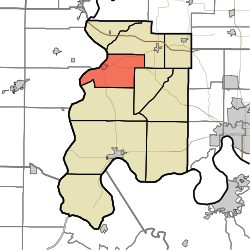
Harmony Township, Posey County, Indiana
| Harmony Township Posey County |
|
|---|---|
| Township | |
 |
|
| Coordinates: 38°07′18″N 87°54′24″W / 38.12167°N 87.90667°WCoordinates: 38°07′18″N 87°54′24″W / 38.12167°N 87.90667°W | |
| Country | United States |
| State | Indiana |
| County | Posey |
| Government | |
| • Type | Indiana township |
| Area | |
| • Total | 35.93 sq mi (93.05 km2) |
| • Land | 35.24 sq mi (91.28 km2) |
| • Water | 0.68 sq mi (1.77 km2) |
| Elevation | 407 ft (124 m) |
| Population (2000) | |
| • Total | 1,473 |
| • Density | 41.79/sq mi (16.14/km2) |
| FIPS code | 18-31504 |
| GNIS feature ID | 453374 |
Harmony Township is one of ten townships in Posey County, Indiana. As of the 2000 census, its population was 1,473.
Harmony Township was organized in 1821. A large share of the first settlers being Harmonites caused the name to be selected.
The James Elliott Farm and New Harmony Historic District are listed on the National Register of Historic Places.
...
Wikipedia
