Hardinxveld-Giessendam
| Hardinxveld-Giessendam | |||
|---|---|---|---|
| Municipality | |||

Water tower Hardinxveld
|
|||
|
|||
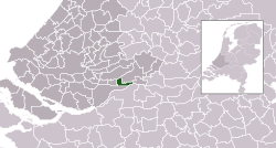
 Location in South Holland |
|||
| Coordinates: 51°49′N 4°50′E / 51.817°N 4.833°ECoordinates: 51°49′N 4°50′E / 51.817°N 4.833°E | |||
| Country | Netherlands | ||
| Province | South Holland | ||
| Established | 1 January 1957 | ||
| Government | |||
| • Body | Municipal council | ||
| • Mayor | Roel Augusteijn (CDA) | ||
| Area | |||
| • Total | 19.35 km2 (7.47 sq mi) | ||
| • Land | 16.92 km2 (6.53 sq mi) | ||
| • Water | 2.43 km2 (0.94 sq mi) | ||
| Elevation | 3 m (10 ft) | ||
| Population (February 2017) | |||
| • Total | 17,751 | ||
| • Density | 1,049/km2 (2,720/sq mi) | ||
| Time zone | CET (UTC+1) | ||
| • Summer (DST) | CEST (UTC+2) | ||
| Postcode | 3370–3373 | ||
| Area code | 0184 | ||
| Website | www |
||
Hardinxveld-Giessendam (Dutch pronunciation: [ˈɦɑrdɪŋksˌfɛlt ˌxisə(n)ˈdɑm]) is a municipality in the western Netherlands, in the province of South Holland. It is located about 10 km east of Dordrecht, on the river Beneden-Merwede. The municipality had a population of 17,751 in 2017 and covers an area of 19.35 km2 (7.47 sq mi) of which 2.43 km2 (0.94 sq mi) is water.
The municipality of Hardinxveld-Giessendam consists of the two population centres Giessendam/Neder-Hardinxveld and Boven-Hardinxveld. Until they were merged in 1957, Giessendam and Hardinxveld were two municipalities, consisting of only a few streets and dykes and only a few thousand inhabitants.
The town's economy is for a large part dependent on ship building (e.g. Damen Shipyards Group) and general contracting. Several industry parks are present.
Dutch topographic map of the municipality of Hardinxveld-Giessendam, June 2015
The village Hardinxveld is one of the oldest settlements of the Alblasserwaard. It is known that in 1105 a priest was present here, and therefore a church as well. Since 1282, Hardinxveld became a grand fiefdom. Through the centuries it suffered from warfare such as the Gelder Wars and the Eighty Years' War
The name Giessendam first appeared in 1231 and is most likely derived from the dam on the little peat river Giessen. This dam was the boundary between Hardinxveld and Giessendam for a long time.
The municipality was formed in 1957 by the merger of the former municipalities Hardinxveld and half of Giessendam. The rest of Giessendam's territory went to the new municipality of Giessenburg which in turn was merged with Giessenlanden in 1986.
...
Wikipedia


