Hardee County
| Hardee County, Florida | ||
|---|---|---|

Hardee County Courthouse
|
||
|
||
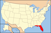
 Location in the U.S. state of Florida |
||
 Florida's location in the U.S. |
||
| Founded | April 23, 1921 | |
| Named for | Cary A. Hardee | |
| Seat | Wauchula | |
| Largest city | Wauchula | |
| Area | ||
| • Total | 638 sq mi (1,652 km2) | |
| • Land | 638 sq mi (1,652 km2) | |
| • Water | 0.6 sq mi (2 km2), 0.1% | |
| Population (est.) | ||
| • (2015) | 27,502 | |
| • Density | 43/sq mi (17/km²) | |
| Congressional district | 17th | |
| Time zone | Eastern: UTC-5/-4 | |
| Website | www |
|
Hardee County is a county located in the U.S. state of Florida. As of the 2010 census, the population was 27,731. Its county seat is Wauchula, Florida. Hardee County comprises the Wauchula, Fla. Micropolitan Statistical Area.
It was named for Cary A. Hardee, Governor of Florida from 1921 to 1925. Hardee County was created in 1921.
On August 13, 2004, Hurricane Charley went directly through Hardee County. Maximum sustained winds in downtown Wauchula were clocked at 149 mph (240 km/h) with higher gusts. Most buildings in the county sustained damage, and many were totally destroyed.
According to the U.S. Census Bureau, the county has a total area of 638 square miles (1,650 km2), of which 638 square miles (1,650 km2) is land and 0.6 square miles (1.6 km2) (%) is water.
As of the census of 2000, there were 26,938 people, 8,166 households, and 6,255 families residing in the county. The population density was 42 people per square mile (16/km²). There were 9,820 housing units at an average density of 15 per square mile (6/km²). The racial makeup of the county was 70.66% White, 8.33% Black or African American, 0.68% Native American, 0.30% Asian, 0.06% Pacific Islander, 17.99% from other races, and 1.97% from two or more races. 35.68% of the population were Hispanic or Latino of any race.
...
Wikipedia

