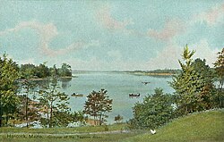
Hancock, Maine
| Hancock, Maine | |
|---|---|
| Town | |

Taunton Bay in 1908
|
|
| Location within the state of Maine | |
| Coordinates: 44°31′28″N 68°16′59″W / 44.52444°N 68.28306°W | |
| Country | United States |
| State | Maine |
| County | Hancock |
| Incorporated | 1828 |
| Area | |
| • Total | 38.87 sq mi (100.67 km2) |
| • Land | 30.04 sq mi (77.80 km2) |
| • Water | 8.83 sq mi (22.87 km2) |
| Elevation | 95 ft (29 m) |
| Population (2010) | |
| • Total | 2,394 |
| • Estimate (2012) | 2,388 |
| • Density | 79.7/sq mi (30.8/km2) |
| Time zone | Eastern (EST) (UTC-5) |
| • Summer (DST) | EDT (UTC-4) |
| ZIP code | 04640 |
| Area code(s) | 207 |
| FIPS code | 23-30970 |
| GNIS feature ID | 0582509 |
| Website | Town of Hancock, Maine |
Hancock is a town in Hancock County, Maine, United States. The population was 2,394 at the 2010 census. Located on the mainland at the head of Frenchman Bay, Hancock has commanding views of Mount Desert Island.
It was first settled in 1766 by Philip and S. Hodgkins from Georgetown. Formed from portions of Sullivan, Trenton and Plantation No. 8, the town was incorporated by the state legislature on February 21, 1828 and named for John Hancock, signer of the Declaration of Independence. It had two water power sites to operate mills—the Kilkenny and Egypt streams. There was one gristmill, four shingle mills and four lath mills. Other products included staves, lumber, boots, shoes, wagons and sleighs. Many inhabitants were engaged in seafaring, particularly fishing at the Grand Banks.
During World War II, German spies Erich Gimpel and William Colepaugh landed by submarine in Hancock, then traveled to New York City. These spies would eventually be captured, tried, and sentenced to death before their sentences were commuted and they were eventually released.
...
Wikipedia

