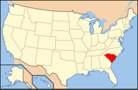
Hampton County, South Carolina
| Hampton County, South Carolina | |
|---|---|

Hampton County Courthouse
|
|
 Location in the U.S. state of South Carolina |
|
 South Carolina's location in the U.S. |
|
| Founded | 1878 |
| Seat | Hampton |
| Largest town | Hampton |
| Area | |
| • Total | 563 sq mi (1,458 km2) |
| • Land | 560 sq mi (1,450 km2) |
| • Water | 2.8 sq mi (7 km2), 0.5% |
| Population | |
| • (2010) | 21,090 |
| • Density | 38/sq mi (15/km²) |
| Congressional district | 6th |
| Time zone | Eastern: UTC-5/-4 |
| Website | www |
Hampton County is a rural county located in the U.S. state of South Carolina. As of the 2010 census, the population was 21,090. Its county seat is Hampton. It was named for Confederate Civil War general Wade Hampton, who in the late 1870s was elected as governor of South Carolina. The county includes two small urban clusters: Hampton (2000 pop.: 4,011) and Estill (3,637).
After pushing out the Native Americans, English colonists and later European Americans developed the land largely for rice and cotton plantations, lucrative commodity crops dependent on the labor and skills of enslaved African Americans.
The county had a peak of population in 1910, when agriculture was still the mainstay of the economy. Thousands of African Americans left after that for urban areas, especially in the North, in the Great Migration. The mechanization of agriculture reduced farm jobs.
Since 1970 the county's population has begun to increase, in part due to people wanting second homes in rural areas or coming here to retire.
According to the U.S. Census Bureau, the county has a total area of 563 square miles (1,460 km2), of which 560 square miles (1,500 km2) is land and 2.8 square miles (7.3 km2) (0.5%) is water.
As of the census of 2000, there were 21,386 people, 7,444 households, and 5,315 families residing in the county. The population density was 38 people per square mile (15/km²). There were 8,582 housing units at an average density of 15 per square mile (6/km²). The racial makeup of the county was 42.89% White, 55.67% Black or African American, 0.20% Native American, 0.17% Asian, 0.01% Pacific Islander, 0.62% from other races, and 0.43% from two or more races. 2.56% of the population were Hispanic or Latino of any race.
...
Wikipedia
