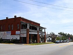
Hamilton, Georgia
| Hamilton, Georgia | |
|---|---|
| City | |

Hamilton, Georgia
|
|
 Location in Harris County and the state of Georgia |
|
| Coordinates: 32°45′53″N 84°52′23″W / 32.76472°N 84.87306°WCoordinates: 32°45′53″N 84°52′23″W / 32.76472°N 84.87306°W | |
| Country | United States |
| State | Georgia |
| County | Harris |
| Area | |
| • Total | 2.1 sq mi (5.4 km2) |
| • Land | 2.1 sq mi (5.4 km2) |
| • Water | 0 sq mi (0 km2) |
| Elevation | 771 ft (235 m) |
| Population (2014) | |
| • Total | 1,056 |
| Time zone | Eastern (EST) (UTC-5) |
| • Summer (DST) | EDT (UTC-4) |
| ZIP code | 31811 |
| Area code(s) | 706 |
| FIPS code | 13-36220 |
| GNIS feature ID | 0315055 |
| Website | http://hamiltoncityhall.net/ |
Hamilton is a city in, and the county seat of Harris County, Georgia, United States. It is part of the Columbus, Georgia-Alabama Metropolitan Statistical Area. The population was 1,056 at the 2014 census estimate.
Hamilton was founded in 1827 as seat of the newly formed Harris County. It was incorporated as a town in 1828 and as a city in 1903.
The city was named for U.S. Secretary of the Navy and Governor of South Carolina, Paul Hamilton (1762-1816).
In January 1912, the lynching of a black woman and three black men in Hamilton attracted national attention from the press and widespread outrage. Dusky Crutchfield, Eugene Harrington, Burrell Hardaway, and Johnie Moore had been held for questioning in the death of a white landowner. They were later shown to have been utterly innocent. They had never even been arrested. A mob of white men took them outside town, hanged and shot them. While many white families tried to build walls of silence around the murders, the effects of these crimes were long-lasting. Coverage by local white newspapers at the time suggested the four were guilty. The Montgomery Advertiser did not even report their names correctly.
Hamilton is located at 32°45′53″N 84°52′23″W / 32.76472°N 84.87306°W (32.764669, -84.873103).U.S. Route 27 runs through the city from north to south, leading southwest 25 mi (40 km) to Columbus and north 8 mi (13 km) to Pine Mountain. Georgia State Route 116 intersects U.S. Route 27 in the city for a very short concurrency. Atlanta is 87 mi (140 km) by road to the northeast. The city is located at the southern base of the Pine Mountain Range, the most southern mountain range of the U.S. Appalachian Mountains.
...
Wikipedia
