Hämikon
| Hämikon | ||
|---|---|---|
| Former municipality of Switzerland | ||
|
||
| Coordinates: 47°14′N 8°17′E / 47.233°N 8.283°ECoordinates: 47°14′N 8°17′E / 47.233°N 8.283°E | ||
| Country | Switzerland | |
| Canton | Lucerne | |
| District | Hochdorf | |
| Area | ||
| • Total | 4.62 km2 (1.78 sq mi) | |
| Elevation | 680 m (2,230 ft) | |
| Population | ||
| • Total | 474 | |
| • Density | 100/km2 (270/sq mi) | |
| Postal code | 6289 | |
| SFOS number | 1028 | |
| Surrounded by | Aesch, Altwis, Buttwil (AG), Hitzkirch, Müswangen, Schongau, Sulz | |
| Website | Profile (German), SFSO statistics |
|
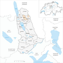
Hämikon is a municipality in the district of Hochdorf in the canton of Lucerne in Switzerland. On 1 January 2009 it became part of the municipality of Hitzkirch.
Hämikon is first mentioned in 924 as Hamminchova.
Hämikon has an area of 4.6 km2 (1.8 sq mi). Of this area, 66.8% is used for agricultural purposes, while 27.4% is forested. The rest of the land, (5.8%) is settled. The municipality is located on the western slope of the Lindenberg mountain. On 21 May 2006 an attempt to merge the Hitzkirch and the surrounding 10 municipalities failed, when five of the eleven voted against the merger. A less ambitious merger was then proposed and accepted, with the municipalities of Gelfingen, Hämikon, Mosen, Müswangen, Retschwil and Sulz joining Hitzkirch.
Hämikon has a population (as of 2007[update]) of 474, of which 3.6% are foreign nationals. Over the last 10 years the population has grown at a rate of 11.3%. Most of the population (as of 2000[update]) speaks German (97.5%), with Portuguese being second most common ( 0.9%) and Albanian being third ( 0.9%).
In the 2007 election the most popular party was the CVP which received 34.5% of the vote. The next three most popular parties were the SVP (27.8%), the FDP (24%) and the Green Party (5.9%).
...
Wikipedia


