Gwersyllt
| Gwersyllt | |
|---|---|
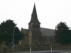
 Gwersyllt's parish church, Holy Trinity |
|
| Gwersyllt shown within Wrexham | |
| Population | 10,677 (2011) |
| OS grid reference | SJ316537 |
| Community |
|
| Principal area | |
| Ceremonial county | |
| Country | Wales |
| Sovereign state | United Kingdom |
| Post town | WREXHAM |
| Postcode district | LL11 |
| Dialling code | 01978 |
| Police | North Wales |
| Fire | North Wales |
| Ambulance | Welsh |
| EU Parliament | Wales |
| UK Parliament | |
| Welsh Assembly | |
Gwersyllt (pronounced [ɡwɛrsɪɬt]) is an urban village and a local government community, the lowest tier of local government, part of Wrexham County Borough in Wales.
The densely populated village is one of Wrexham's largest and is situated in the north western suburbs of the town, bordering the nearby villages of Llay, Cefn-y-Bedd, and Sydallt. The community, also including the villages of Summerhill and Bradley, had a total population of 10,056 at the 2001 census, rising to 10,677 at the 2011 Census.
The name is usually stated to be derived from the Welsh word, gwersyll, meaning "campsite", with the final t common in the area's dialect. This is, however, a comparatively modern form, and during the mediaeval period the name was written as "Wershull" or "Wersull", with "Gwershull" and "Wersham" occurring in the 16th century. It is therefore possible that the present name, like others in the area, is a Welsh adaptation of an earlier English name ending in "-hull" (i.e. "hill").
Gwersyllt was originally a township of the parish of Gresford, and by 1833 had 834 inhabitants. The gradual increase of the area's population in the industrial era led to Gwersyllt being formed as a new parish in 1851, combining the old township of Gwersyllt and parts of the neighbouring township of Stansty. The parish church, from plans by Thomas Penson, was consecrated at the same time.
The village grew rapidly with the local coal mining industry and the area was home to several collieries, of which many features still remain. In 1896, the Gwersyllt coal mine owned by Edward Griffiths had 185 employees with 167 below ground. It was in operation by 1881.
The area was situated between the collieries of the Moss Valley and Bradley and benefitted from good rail links on the former Wrexham, Mold and Connah's Quay Railway to Wrexham, Birkenhead, Ellesmere, Brymbo and New Brighton. A canal also was planned to run through the community with the intention of forming part of the Ellesmere Canal. Evidence of the canal cuttings can still be seen alongside the Sydallt junction between the Summerhill Bottom Road and A541 Mold Road, and a local street, named Heol-y-Camlas, meaning Canal Road in Welsh, lies on the former canal alignment.
...
Wikipedia

