Gwalior Airport
| Gwalior airport | |||||||||||
|---|---|---|---|---|---|---|---|---|---|---|---|

|
|||||||||||
| Summary | |||||||||||
| Airport type | Military/Public | ||||||||||
| Owner | Indian Air Force | ||||||||||
| Operator | Indian Air Force/Airports Authority of India | ||||||||||
| Serves | Gwalior | ||||||||||
| Location | Gwalior, Madhya Pradesh, India | ||||||||||
| Elevation AMSL | 617 ft / 188 m | ||||||||||
| Coordinates | 26°17′36″N 078°13′40″E / 26.29333°N 78.22778°ECoordinates: 26°17′36″N 078°13′40″E / 26.29333°N 78.22778°E | ||||||||||
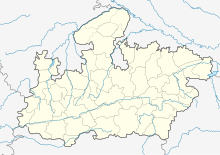
| Map | |||||||||||
| Runways | |||||||||||
|
|||||||||||
The Gwalior airport, officially Rajmata Vijaya Raje Scindia Air Terminal, (IATA: GWL, ICAO: VIGR) is a civil enclave airport at the Maharajpur Air Force Station 10 km north-east of Gwalior, Madhya Pradesh, India. It is one of the four airports in Madhya Pradesh.
The airport is spread over 29.5 acres and the terminal can handle 200 passengers per hour. The 100-by-150-metre (330 ft × 490 ft) apron can handle two Airbus A320 and one small aircraft simultaneously. The Gwalior Air Base is the only operational air force base with two operational parallel runways. The second runway was built in February 2009 and became operational in October 2010.
...
Wikipedia


