Gwaii Haanas National Park Reserve and Haida Heritage Site
| Gwaii Haanas National Park Reserve and Haida Heritage Site | |
|---|---|
|
IUCN category II (national park)
|
|

Queen Charlotte Islands Map; Gwaii Haanas is at the southern end
|
|
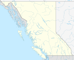
| Location of Gwaii Haanas National Park in Canada | |
| Location | Haida Gwaii (formerly Queen Charlotte Islands), British Columbia, Canada |
| Nearest city | Sandspit |
| Coordinates | 52°23′21″N 131°28′16″W / 52.38917°N 131.47111°WCoordinates: 52°23′21″N 131°28′16″W / 52.38917°N 131.47111°W |
| Area | 1,470 km2 (570 sq mi) |
| Established | 1988 |
| Governing body | Gwaii Haanas Archipelago Management Board |
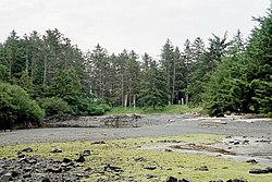
| SG̱ang Gwaay Llnaagay | |
|---|---|

A former Haida village at the site
|
|
| Type | Cultural |
| Criteria | iii |
| Designated | 1981 (5th session) |
| Reference no. | 157 |
| State Party | Canada |
| Region | Europe and North America |
| Official name: Nan Sdins National Historic Site of Canada | |
| Designated | 1981 |
Gwaii Haanas National Park Reserve and Haida Heritage Site, often referred to simply as Gwaii Haanas, is located in the southernmost Haida Gwaii (formerly known as Queen Charlotte Islands), 130 kilometres (81 miles) off the mainland of British Columbia, Canada. Gwaii Haanas protects an archipelago of 138 islands, the largest being Moresby Island and the southernmost being Kunghit Island.
The park was the subject of a short film in 2011's National Parks Project, directed by Scott Smith and scored by Sarah Harmer, Jim Guthrie and Bry Webb.
From the 1970s through the early 1980s, plans to expand logging to Burnaby Island led to controversy, and the first concerted efforts to protect Gwaii Haanas. The "South Moresby Wilderness Proposal" was drawn up in an effort to stem natural resource exploitation.
To prevent logging, the Haida Nation designated the "Haida Heritage Site" in 1985, encompassing roughly the southern third of the archipelago. Importantly, the Heritage Site included a swath of land and sea, both terrestrial and marine areas. However, logging continued, amidst legal and political battles. In 1987, logging ended when the governments of Canada and British Columbia signed the South Moresby Memorandum of Understanding.
This accord led to the South Moresby Agreement a year later, which created South Moresby National Park Reserve. It was not a full national park; it was an area reserved to become a national park, because there were outstanding claims to land ownership among federal and tribal governments. But the measure safeguarded the area, and permitted shared stewardship. It would be managed as if it were a national park, pending land claims.
In 1993 the Government of Canada and the Council of the Haida Nation signed the Gwaii Haanas Agreement, which changed the name of the national park reserve to a native name. This Agreement expresses respect for both Canadian and Haida designations and interests, and includes a mutual commitment to the protection of Gwaii Haanas. Because the park reserve and the Haida Heritage Site nearly coincide (on land), its official name reflected both designations: Gwaii Haanas National Park Reserve and Haida Heritage Site.
...
Wikipedia

