Guovdageaidnu Kautokeino
|
Kautokeino kommune Guovdageainnu suohkan |
|||
|---|---|---|---|
| Municipality | |||
 |
|||
|
|||
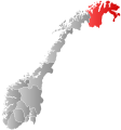
 Kautokeino within Finnmark |
|||
| Coordinates: 69°00′42″N 23°02′36″E / 69.01167°N 23.04333°ECoordinates: 69°00′42″N 23°02′36″E / 69.01167°N 23.04333°E | |||
| Country | Norway | ||
| County | Finnmark | ||
| Administrative centre | Kautokeino | ||
| Government | |||
| • Mayor (2015) | Johan Vasara (Ap) | ||
| Area | |||
| • Total | 9,707.33 km2 (3,748.02 sq mi) | ||
| • Land | 8,968.87 km2 (3,462.90 sq mi) | ||
| • Water | 738.46 km2 (285.12 sq mi) | ||
| Area rank | 1 in Norway | ||
| Population (2017) | |||
| • Total | 2,938 ( |
||
| • Rank | 272 in Norway | ||
| • Density | 0.3/km2 (0.8/sq mi) | ||
| • Change (10 years) | -0.9 % | ||
| Time zone | CET (UTC+1) | ||
| • Summer (DST) | CEST (UTC+2) | ||
| ISO 3166 code | NO-2011 | ||
| Official language form | Bokmål and Sami | ||
| Website | www |
||
|
|
|||
![]() Kautokeino (Norwegian) or Guovdageaidnu (Northern Sami) (also: Finnish: Koutokeino and Kven: Koutokeino) is a municipality in Finnmark county, Norway. The administrative centre of the municipality is the village of Guovdageaidnu/Kautokeino. Other villages include Láhpoluoppal and Máze.
Kautokeino (Norwegian) or Guovdageaidnu (Northern Sami) (also: Finnish: Koutokeino and Kven: Koutokeino) is a municipality in Finnmark county, Norway. The administrative centre of the municipality is the village of Guovdageaidnu/Kautokeino. Other villages include Láhpoluoppal and Máze.
The 9,707-square-kilometre (3,748 sq mi) municipality is the largest by area out of the 426 municipalities in Norway. Kautokeino is the 272nd most populous municipality in Norway with a population of 2,938. The municipality's population density is 0.3 inhabitants per square kilometre (0.78/sq mi) and its population has decreased by 0.9% over the last decade.
Guovdageaidnu-Kautokeino is one of two cultural centers of Northern Sápmi today (other being Kárášjohka-Karasjok). The most significant industries are reindeer herding, theatre/movie industry, and the public education system.
...
Wikipedia


