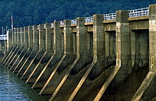
Guntersville Dam
| Guntersville Dam | |
|---|---|

Guntersville Dam
|
|
| Official name | Guntersville Dam |
| Location | Marshall County, Alabama, United States |
| Coordinates | 34°25′16″N 86°23′35″W / 34.42111°N 86.39306°WCoordinates: 34°25′16″N 86°23′35″W / 34.42111°N 86.39306°W |
| Construction began | December 4, 1935 |
| Opening date | January 17, 1939 |
| Operator(s) | Tennessee Valley Authority |
| Dam and spillways | |
| Impounds | Tennessee River |
| Height | 94 ft (29 m) |
| Length | 3,979 ft (1,213 m) |
| Reservoir | |
| Creates | Guntersville Lake |
| Total capacity | 1,049,000 acre·ft (1,294,000 dam3) |
| Catchment area | 24,450 sq mi (63,300 km2) |
Guntersville Dam is a hydroelectric dam on the Tennessee River in Marshall County, in the U.S. state of Alabama. It is one of nine dams on the river owned and operated by the Tennessee Valley Authority, which built the dam in the late 1930s as part of a New Deal era initiative to create a continuous navigation channel on the entire length of the river and bring flood control and economic development to the region. The dam impounds the Guntersville Lake of 67,900 acres (27,500 ha), and its tailwaters feed into Wheeler Lake.
Guntersville Dam is named for the city of Guntersville, Alabama, which is located about 10 miles (16 km) upstream. The city is named for its first settler, John Gunter (d. 1836), who arrived in the late 18th century.
Guntersville Dam is located 349 miles (562 km) above the mouth of the Tennessee River, at a point where the southwestward-flowing river begins to change its course to a more northwestwardly direction. The dam's reservoir stretches for nearly 73 miles (117 km) to the base of Nickajack Dam, and includes parts of Marshall and Jackson counties in Alabama and Marion County in Tennessee. The reservoir's backwaters have formed embayments on the lower parts of Browns Creek and Spring Creek to the west and east of the city of Guntersville, respectively, effectively placing the city at the tip of a long peninsula.
Guntersville Dam is 94 feet (29 m) high and 3,979 feet (1,213 m) wide, and has a generating capacity of 140,400 kilowatts of electricity. The dam's 18-bay spillway has a total discharge capacity of 478,000 cubic feet per second (13,500 m3/s). Its reservoir has a storage capacity of 1,049,000 acre·ft (1,294,000 dam3), with 162,000 acre·ft (200,000 dam3) reserved for flood control. The reservoir is the most stable reservoir in the TVA system, fluctuating just 2 feet (0.61 m) per year.
...
Wikipedia
