Gulf Shores, Alabama
| Gulf Shores, Alabama | |
|---|---|
| City | |

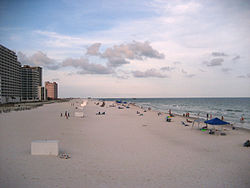
Condominiums and hotels on the beach
|
|
| Motto: Small Town, Big Beach | |
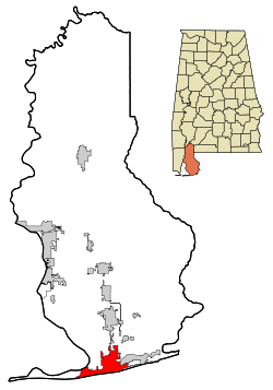
 Location in Baldwin County and the state of Alabama |
|
| Coordinates: 30°16′4″N 87°42′5″W / 30.26778°N 87.70139°W | |
| Country | United States |
| State | Alabama |
| County | Baldwin |
| Government | |
| • Mayor | Robert Craft |
| Area | |
| • Total | 28.0 sq mi (72.5 km2) |
| • Land | 23.2 sq mi (60.0 km2) |
| • Water | 4.8 sq mi (12.5 km2) |
| Elevation | 7 ft (2 m) |
| Population (2013) | |
| • Total | 10,675 |
| • Density | 421/sq mi (162.4/km2) |
| Time zone | Central (CST) (UTC-6) |
| • Summer (DST) | CDT (UTC-5) |
| ZIP code | 36542, 36547 |
| Area code(s) | 251 |
| FIPS code | 01-32272 |
| GNIS feature ID | 0119462 |
| Website | www |
Gulf Shores is a resort city in Baldwin County, Alabama, United States. As of the 2010 Census, the population was 9,741.
Gulf Shores is located on the Gulf of Mexico at 30°16'4.069" North, 87°42'5.285" West (30.267797, −87.701468). It is the southernmost settlement in the state of Alabama. It is served by Alabama State Route 59 (Gulf Shores Parkway), which leads north to Foley. Route 182 (Beach Boulevard) runs east-west along the shore front, while Route 180 (Fort Morgan Road) runs parallel to it, north of Little Lagoon. Gulf State Park occupies a large eastern part of the city.
Gulf Shores is located 33 miles west of Pensacola, FL, 54 miles south of Mobile, AL, 197 miles east of New Orleans, LA, and 194 miles south of Montgomery, AL.
Gulf Shores is located in Baldwin County. Bordering Baldwin County are the following counties: Mobile, Washington, Clarke, Monroe and Escambia.
According to the U.S. Census Bureau, the city has a total area of 28.0 square miles (72.5 km2), of which 23.2 square miles (60.0 km2) is land and 4.8 square miles (12.5 km2), or 17.24%, is water.
The location of Gulf Shores on the northern coast of the Gulf of Mexico makes it vulnerable to hurricanes. In September 1979, Hurricane Frederic leveled most of the town. In September 2004, Hurricane Ivan caused extensive wind and flooding damage. In 2005, while the city was still cleaning up from Ivan, Hurricane Katrina caused extensive damage and flooding.
As of the census of 2010, there were 9,741 people residing in the city. The population density was 274.3 per square mile (105.9/km2). There were 6,810 housing units at an average density of 370.4 per square mile (143.0/km2). The racial makeup of the city was 97.54% White, 0.22% Black or African American, 0.44% Native American, 0.30% Asian, 0.04% Pacific Islander, 0.40% from other races, and 1.07% from two or more races. 1.23% of the population were Hispanic or Latino of any race.
...
Wikipedia
