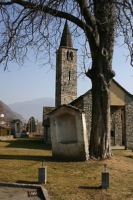
Gudo
| Gudo | ||
|---|---|---|
| Former municipality of Switzerland | ||
 |
||
|
||
| Coordinates: 46°10′N 8°57′E / 46.167°N 8.950°ECoordinates: 46°10′N 8°57′E / 46.167°N 8.950°E | ||
| Country | Switzerland | |
| Canton | Ticino | |
| District | Bellinzona | |
| Government | ||
| • Mayor | Sindaco | |
| Area | ||
| • Total | 9.94 km2 (3.84 sq mi) | |
| Elevation | 232 m (761 ft) | |
| Population (December 2004) | ||
| • Total | 754 | |
| • Density | 76/km2 (200/sq mi) | |
| Postal code | 6515 | |
| SFOS number | 5008 | |
| Surrounded by | Cadenazzo, Cugnasco, Giubiasco, Sant'Antonino, Sementina | |
| Website |
www SFSO statistics |
|
Gudo is a former municipality in the district of Bellinzona in the canton of Ticino in Switzerland.
On 2 April 2017 the former municipalities of Camorino, Claro, Giubiasco, Gnosca, Gorduno, Moleno, Pianezzo, Preonzo, Sant'Antonio and Sementina merged into the new municipality of Bellinzona.
In 1909-10, work on the banks of the Ticino river in the hamlet of Progero uncovered an extensive prehistoric burial ground. This site, known as A Progero is a Swiss heritage site of national significance. The oldest finds are pottery fragments, indicating that the area was probably inhabited in the Early Bronze Age (17th-16th century BC). The next layer of finds included grave pottery from the Late Bronze Age (13th-12th century BC). Most of the necropolis (over 300 graves) dates from the Iron Age (6th Century BC). This settlement is from the Golasecca culture and lasted until about the 2nd Century BC. The graves from this period are almost exclusively full-body burials. The graves are surrounded by stone walls and covered with boards or stones arranged around the top. In some cases the stele stones with inscriptions have been found close to the graves.
...
Wikipedia


