Guapiara
| Guapiara | |
|---|---|
| Municipality | |
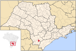
 Location in São Paulo state |
|
| Location in Brazil | |
| Coordinates: 24°11′6″S 48°31′58″W / 24.18500°S 48.53278°WCoordinates: 24°11′6″S 48°31′58″W / 24.18500°S 48.53278°W | |
| Country |
|
| Region | Southeast Region |
| State | São Paulo |
| Area | |
| • Total | 408 km2 (158 sq mi) |
| Population (2015) | |
| • Total | 17,879 |
| • Density | 44/km2 (110/sq mi) |
| Time zone | BRT/BRST (UTC-3/-2) |
Guapiara is a municipality in the state of São Paulo in Brazil. The population is 17,879 (2015 est.) in an area of 408 km². Its elevation is 750 m.
The municipality contains part of the 488,865 hectares (1,208,010 acres) Serra do Mar Environmental Protection Area, created in 1984. It contains part of the 41,704 hectares (103,050 acres) Intervales State Park, created in 1995.
...
Wikipedia

