Guadalupe (Santa Cruz da Graciosa)
| Guadalupe | ||
| Civil Parish (Freguesia) | ||
|
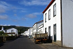
Partial vista of the Ribeirinha, in Guadalupe, showing the windmill farm on the Serra Branca
|
||
|
||
| Official name: Freguesia da Nossa Senhora de Guadalupe | ||
| Name origin: Nossa Senhora de Guadalupe | ||
| Country | ||
|---|---|---|
| Autonomous Region | ||
| Island | Graciosa | |
| Municipality | Santa Cruz da Graciosa | |
| Localities | Almas, Brasileira, Guadalupe, Ribeirinha, Vitória | |
| Center | Almas | |
| - elevation | 166 m (545 ft) | |
| - coordinates | 39°3′8.58″N 28°1′41.73″W / 39.0523833°N 28.0282583°WCoordinates: 39°3′8.58″N 28°1′41.73″W / 39.0523833°N 28.0282583°W | |
| Highest point | Pico Timão | |
| - elevation | 398 m (1,306 ft) | |
| - coordinates | 39°2′19″N 28°0′32″W / 39.03861°N 28.00889°W | |
| Lowest point | Sea level | |
| - location | Atlantic Ocean | |
| - elevation | 0 m (0 ft) | |
| Area | 20.62 km2 (8 sq mi) | |
| - water | .001 km2 (0 sq mi) | |
| - urban | 1.26 km2 (0 sq mi) | |
| Population | 1,096 (2011) | |
| Density | 53/km2 (137/sq mi) | |
| LAU | Junta Freguesia | |
| - location | Caminho da Igreja | |
| President Junta | Tomás da Cunha Picanço (PPD-PSD) | |
| Timezone | Azores (UTC-1) | |
| - summer (DST) | Azores (UTC0) | |
| Postal Zone | 9880-021 | |
| Area Code & Prefix | (+351) 292 XXX-XXXX | |
| Demonym | Guadalupense | |
| Patron Saint | Nossa Senhora de Guadalupe | |
Guadalupe is a civil parish in the municipality of Santa Cruz da Graciosa, on Graciosa in the Portuguese archipelago of the Azores. The population in 2011 was 1,096, occupying an area of 20.62 square kilometres (7.96 sq mi) on the island of Graciosa.
The fertile lands were first settled in the early 16th century, resulting in narrow parcels radiating from north to south.
Guadalupe became the centre of cereal production on the island, with the lands acquired by many of the principal families of Santa Cruz. Consequently, many of the great houses obtained their wealth from the fields and pasturelands in the west.
The parish was create in 1644, following the disaggregation of the western half of the municipality of Santa Cruz da Graciosa, which was then part of the Vila da Praia) and the parish of Santa Cruz da Graciosa.
With a population exceeding 3000 inhabitants by the 19th century, for many years the parish was the most populous centre of the island, surpsassing the populations in the principal urban centres: Praia and Santa Cruz.
The parish of Guadalupe is constituted by several agglomerations, aligned in a dispersed-oriented form along the islands main roadways. It is a multi-polar structure, highlighted by isolated centres that include some residences, churches, schools and impérios, while the majority of homesteads are dispersed along the roadways. The parish is therefore an administrative entity, rather the a social construct; residents are adhere, therefore, more to their locality, rather then the parish.
The principal localities in the parish, include:
This fertility and open space made settlement and population growth rapid, especially between the end of 15th century and 1550. With increased poverty, the population began to decrease, resulting in an exodus to the United States by the second half of the 20th century.
...
Wikipedia


