Grundy Center, Iowa
| Grundy Center, Iowa | |
|---|---|
| City | |

Downtown
|
|
| Motto: "The Good Life" | |
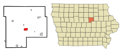
 Location of Grundy Center, Iowa |
|
| Coordinates: 42°21′40″N 92°46′25″W / 42.36111°N 92.77361°WCoordinates: 42°21′40″N 92°46′25″W / 42.36111°N 92.77361°W | |
| Country |
|
| State |
|
| County | Grundy |
| Incorporated | April 17, 1877 |
| Area | |
| • Total | 2.53 sq mi (6.55 km2) |
| • Land | 2.53 sq mi (6.55 km2) |
| • Water | 0 sq mi (0 km2) |
| Elevation | 1,024 ft (312 m) |
| Population (2010) | |
| • Total | 2,706 |
| • Estimate (2012) | 2,715 |
| • Density | 1,069.6/sq mi (413.0/km2) |
| Time zone | Central (CST) (UTC-6) |
| • Summer (DST) | CDT (UTC-5) |
| ZIP code | 50638 |
| Area code(s) | 319 |
| FIPS code | 19-33195 |
| GNIS feature ID | 0457172 |
| Website | Grundy Center, Iowa |
Grundy Center is a city in Grundy County, Iowa, United States. The population was 2,706 at the 2010 census a 4.2% increase from 2,596 at the 2000 census. Grundy Center is also the county seat of Grundy County. Grundy Center is part of the Waterloo–Cedar Falls Metropolitan Statistical Area.
Grundy Center, more commonly known by residents as Grundy, has three public education centers. The centers are K-12, with the kindergarten through 4th grade in the primary building, and grade levels 4-12 located at the Jr-Sr High School building. The community preschool is located in the upper elementary, which is also shared by the YMCA early childhood center. The city of Grundy Center also has three public parks, The Bel Pre, Orion, and The Liberty Park. Located just south of the Liberty Park is the city swimming pool, that is open only in the summer months. The Herbert Quick School House is a historic building in Grundy Center, located within the Orion city park.
Grundy Center was incorporated on April 17, 1877, and was named for the county, which was named for Felix Grundy, congressman and senator from Tennessee.
Grundy Center is located at 42°21′40″N 92°46′25″W / 42.36111°N 92.77361°W (42.361058, -92.773550).
According to the United States Census Bureau, the city has a total area of 2.53 square miles (6.55 km2), all of it land.
As of the census of 2010, there were 2,706 people, 1,162 households, and 739 families residing in the city. The population density was 1,069.6 inhabitants per square mile (413.0/km2). There were 1,256 housing units at an average density of 496.4 per square mile (191.7/km2). The racial makeup of the city was 98.6% White, 0.2% African American, 0.1% Asian, 0.1% Pacific Islander, and 1.0% from two or more races. Hispanic or Latino of any race were 0.4% of the population.
...
Wikipedia
