Grone
| Grône | ||
|---|---|---|
|
||
| Coordinates: 46°15′N 7°27′E / 46.250°N 7.450°ECoordinates: 46°15′N 7°27′E / 46.250°N 7.450°E | ||
| Country | Switzerland | |
| Canton | Valais | |
| District | Sierre | |
| Government | ||
| • Mayor | Joseph De Preux | |
| Area | ||
| • Total | 21.14 km2 (8.16 sq mi) | |
| Elevation | 513 m (1,683 ft) | |
| Population (Dec 2015) | ||
| • Total | 2,311 | |
| • Density | 110/km2 (280/sq mi) | |
| Postal code | 3979 | |
| SFOS number | 6238 | |
| Surrounded by | Chalais, Nax, Anniviers, Saint-Léonard, Sierre, Sion | |
| Website |
www SFSO statistics |
|
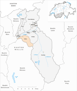
Grône is a municipality in the district of Sierre in the canton of Valais in Switzerland.
Grône is first mentioned around 1001-1100 as in Gruona. The municipality was formerly known by its German name Grün, however, that name is no longer used.
Grône has an area, as of 2009[update], of 21.1 square kilometers (8.1 sq mi). Of this area, 4.07 km2 (1.57 sq mi) or 19.3% is used for agricultural purposes, while 13.56 km2 (5.24 sq mi) or 64.1% is forested. Of the rest of the land, 1.64 km2 (0.63 sq mi) or 7.8% is settled (buildings or roads), 0.13 km2 (32 acres) or 0.6% is either rivers or lakes and 1.7 km2 (0.66 sq mi) or 8.0% is unproductive land.
Of the built up area, housing and buildings made up 4.2% and transportation infrastructure made up 1.6%. Power and water infrastructure as well as other special developed areas made up 1.5% of the area Out of the forested land, 58.1% of the total land area is heavily forested and 2.7% is covered with orchards or small clusters of trees. Of the agricultural land, 1.5% is used for growing crops and 2.7% is pastures, while 5.1% is used for orchards or vine crops and 10.0% is used for alpine pastures. Of the water in the municipality, 0.4% is in lakes and 0.2% is in rivers and streams. Of the unproductive areas, 6.1% is unproductive vegetation and 2.0% is too rocky for vegetation.
The municipality is located in the Sierre district. The main village lies in the Rhone valley with about ten hamlets in the hills above the village. The hamlets include Loye, Daillet, Itravers and Erdesson. Erdesson was formerly known as Merdesson, but the name was changed after it was rebuilt following a devastating fire in 1912. In the early history of the municipality, the village was often destroyed due to the Rhone floods, so the settlements in the hills were much more important. In 1292, both Grône and Loye were both municipalities.
The blazon of the municipal coat of arms is Azure an Ibex rampant Argent on Coupeaux Vert.
...
Wikipedia


