Grike (Lake District)
| Grike | |
|---|---|

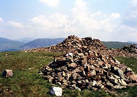
Grike summit with its massive cairn and two smaller ones.
|
|
| Highest point | |
| Elevation | 488 m (1,601 ft) |
| Prominence | c. 37 m |
| Parent peak | Crag Fell |
| Listing | Wainwright |
| Coordinates | 54°30′47″N 3°24′54″W / 54.513°N 3.415°WCoordinates: 54°30′47″N 3°24′54″W / 54.513°N 3.415°W |
| Geography | |
| Location | Cumbria, England |
| Parent range | Lake District, Western Fells |
| OS grid | NY086141 |
| Topo map | OS Landranger 89, 90, Explorer OL4 |
Grike is a hill in the west of the English Lake District, near Ennerdale Water. It is part of the Lank Rigg group, the most westerly Wainwright as the fells diminish toward the coastal plain. It can be climbed from Kinniside or Ennerdale Bridge.
The Western Fells occupy a triangular sector of the Lake District, bordered by the River Cocker to the north east and Wasdale to the south east. Westwards, the hills diminish toward the coastal plain of Cumberland. At the central hub of the high country are Great Gable and its satellites, while two principal ridges fan out on either flank of Ennerdale, the western fells in effect being a great horseshoe around this long wild valley. Grike stands at the extremity of the southern arm.
The main watershed runs broadly westwards from Great Gable, dividing the headwaters of Ennerdale and Wasdale. The fells in this section are Kirk Fell, Pillar, Scoat Fell, Haycock and Caw Fell. The surrounding valleys gradually diverge until other rivers spring up to drain the intervening country. Worm Gill is one such watercourse, running southwards from Caw Fell and forcing the ridge to detour northwards around the head of its valley. Beyond this stand the fells of the Lank Rigg group, the final high country within the National Park. Crag Fell and Grike complete the westward line of the ridge, while Lank Rigg itself lies to the south across the head of the River Calder.
The western ridge of Crag Fell narrows to a marshy depression at 1,480 ft, before climbing again up the easy slopes of Grike. The southern flanks of both fells have been planted with a long belt of conifers, running down to the headwaters of the Calder. Grike's northern slopes are also forested where gradient and crags allow. The Ennerdale face is less impressive than that of Crag Fell, although deeply riven by the beds of Ben Gill and Red Gill. Grike looks down not upon the lake itself, but on the floodplain of the River Ehen, its outflowing stream.
...
Wikipedia

