Griffith-Merrillville Airport
| Griffith-Merrillville Airport | |||||||||||
|---|---|---|---|---|---|---|---|---|---|---|---|
| Summary | |||||||||||
| Airport type | Public | ||||||||||
| Owner | Griffith Aviation, Inc. | ||||||||||
| Location | Griffith, Indiana | ||||||||||
| Opened | January 1962 | ||||||||||
| Elevation AMSL | 634 ft / 193 m | ||||||||||
| Coordinates | 41°31′11″N 087°23′58″W / 41.51972°N 87.39944°W | ||||||||||
| Website | GriffithAirport.com | ||||||||||
| Map | |||||||||||
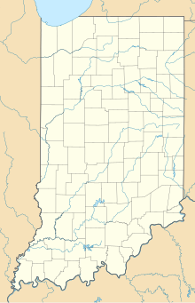
| Location of airport in Indiana/United States | |||||||||||
| Runways | |||||||||||
|
|||||||||||
| Statistics | |||||||||||
|
|||||||||||
|
Sources: Airport and FAA
|
|||||||||||
| Aircraft operations (2006) | 33,699 |
|---|---|
| Based aircraft (2015) | 71 |
Griffith-Merrillville Airport (FAA LID: 05C) is a public-use airport two miles east of Griffith, in Lake County, Indiana, United States. It is privately owned by Griffith Aviation, Inc.
The airport covers 122 acres (49 ha) at an elevation of 634 feet (193 m). Its runway, 8/26, is 4,900 by 75 feet (1,494 x 23 m) asphalt. The runway has VOR/DME, GPS Instrument Approaches and Pilot Controlled Lighting.
Airport services include a fixed-base operator (FBO) and flight school from Griffith Aviation, full service maintenance from Great Northern and custom engine overhauls from G & N Aircraft. Both 100LL gas and Jet A fuel are available.
In the year ending August 23, 2006 the airport had 33,699 aircraft operations, average 92 per day: 99% general aviation and 1% air taxi. In 2015, 71 aircraft were based at the airport: 48 single-engine, 15 multi-engine, 1 jet and 7 helicopters.
...
Wikipedia


