Greenwood, Wisconsin
| Greenwood, Wisconsin | |
|---|---|
| City | |

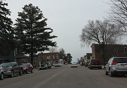
Looking south in downtown Greenwood on WIS73
|
|
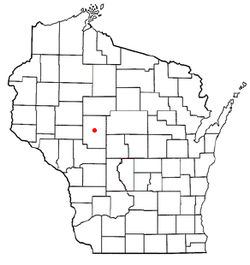
 Location of Greenwood, Wisconsin |
|
| Coordinates: 44°46′4″N 90°35′56″W / 44.76778°N 90.59889°WCoordinates: 44°46′4″N 90°35′56″W / 44.76778°N 90.59889°W | |
| Country | United States |
| State | Wisconsin |
| County | Clark |
| Area | |
| • Total | 2.86 sq mi (7.41 km2) |
| • Land | 2.78 sq mi (7.20 km2) |
| • Water | 0.08 sq mi (0.21 km2) |
| Elevation | 1,181 ft (360 m) |
| Population (2010) | |
| • Total | 1,026 |
| • Estimate (2012) | 1,012 |
| • Density | 369.1/sq mi (142.5/km2) |
| Time zone | Central (CST) (UTC-6) |
| • Summer (DST) | CDT (UTC-5) |
| Area code(s) | 715 & 534 |
| FIPS code | 55-31575 |
| GNIS feature ID | 1565856 |
| Website | greenwoodwi |
Greenwood is a city in Clark County in the U.S. state of Wisconsin. The population was 1,026 at the 2010 census.
Greenwood is located at 44°46′4″N 90°35′56″W / 44.76778°N 90.59889°W (44.767826, -90.598959).
According to the United States Census Bureau, the city has a total area of 2.86 square miles (7.41 km2), of which, 2.78 square miles (7.20 km2) is land and 0.08 square miles (0.21 km2) is water.
The town has a peace memorial, created by Ernest Durig from an artificial stone made using concrete and fine white sand. Unveiled in 1937, it was restored in 1982, and sits adjacent to the 1934 City Hall, on the corner of Main Street and Division Street.
As of the census of 2010, there were 1,026 people, 464 households, and 259 families residing in the city. The population density was 369.1 inhabitants per square mile (142.5/km2). There were 520 housing units at an average density of 187.1 per square mile (72.2/km2). The racial makeup of the city was 97.5% White, 0.9% African American, 0.4% Native American, 0.1% Asian, 0.7% from other races, and 0.5% from two or more races. Hispanic or Latino of any race were 1.5% of the population.
...
Wikipedia
