Greene County, Virginia
| Greene County, Virginia | ||
|---|---|---|

Courthouse, built 1838, in Stanardsville
|
||
|
||
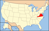
 Location in the U.S. state of Virginia |
||
 Virginia's location in the U.S. |
||
| Founded | 1838 | |
| Named for | Nathanael Greene | |
| Seat | Stanardsville | |
| Largest town | Stanardsville | |
| Area | ||
| • Total | 157 sq mi (407 km2) | |
| • Land | 156 sq mi (404 km2) | |
| • Water | 0.7 sq mi (2 km2), 0.4% | |
| Population (est.) | ||
| • (2015) | 19,162 | |
| • Density | 122/sq mi (47/km²) | |
| Congressional district | 5th | |
| Time zone | Eastern: UTC-5/-4 | |
| Website | www |
|
Greene County is a county in central Virginia in the eastern United States. As of the 2010 census, the population was 18,403. Its county seat is Stanardsville.
Greene County is part of the Charlottesville, VA Metropolitan Statistical Area.
Greene County was established in 1838 from Orange County. The county is named for American Revolutionary War hero Nathanael Greene.
A major incident occurred on October 24, 1979, when a natural gas main ruptured, causing an explosion. The resulting fire destroyed the bell tower of the county courthouse and county office building. However, quick action by the firemen on the scene saved the county records which were secured in the vault.
According to the U.S. Census Bureau, the county has a total area of 156.8 square miles (406.1 km2), of which 156.1 square miles (404.3 km2) is land and 0.7 square miles (1.8 km2) (0.4%) is water. It is the second-smallest county in Virginia by total area.
As of the census of 2010, there are 18,403 people, 6,780 households, and 5,072 families residing in the county. The population density is 117.8 people per square mile (38/km²). There are 7,509 housing units at an average density of 48.1 per square mile (15/km²). The racial makeup of the county is 87.6% White, 6.3% Black or African American, 0.19% Native American, 0.45% Asian, 0.2% Pacific Islander, 0.64% from other races, and 2.2% from two or more races. 4.2% of the population are Hispanic or Latino of any race.
...
Wikipedia

