Green River, Utah
| Green River, Utah | |
|---|---|
| City | |

Aerial photograph of Green River
|
|
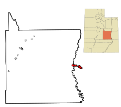
 Location in Emery County and the state of Utah |
|
 Location of Utah in the United States |
|
| Coordinates: 38°59′36″N 110°9′0″W / 38.99333°N 110.15000°WCoordinates: 38°59′36″N 110°9′0″W / 38.99333°N 110.15000°W | |
| Country | United States |
| State | Utah |
| County | Emery |
| Incorporated | 1906 |
| Named for | The Green River |
| Area | |
| • Total | 12.6 sq mi (32.6 km2) |
| • Land | 12.5 sq mi (32.3 km2) |
| • Water | 0.1 sq mi (0.3 km2) |
| Elevation | 4,078 ft (1,243 m) |
| Population (2010) | |
| • Total | 952 |
| • Density | 76/sq mi (29.5/km2) |
| Time zone | Mountain (MST) (UTC-7) |
| • Summer (DST) | MDT (UTC-6) |
| ZIP code | 84525 |
| Area code(s) | 435 |
| FIPS code | 49-31670 |
| GNIS feature ID | 1428398 |
| Website | greenriverutah |
Green River is a city in Emery County, Utah, United States. The population was 952 at the 2010 census.
The city is located on the banks of the Green River, a major tributary of the Colorado River. The San Rafael Swell region is to the west of the city, while Canyonlands National Park lies to the south. Today located exclusively in Emery County, the city was split between Emery and Grand counties until January 6, 2003, when Emery County's boundaries were expanded to follow the city limits.
According to the United States Census Bureau, the city of Green River has a total area of 12.6 square miles (32.6 km2), of which 12.5 square miles (32.3 km2) is land and 0.1 square miles (0.3 km2), or 0.87%, is water.
Interstate 70 passes just south of the city, with access from Exits 160 and 164. The highway leads east 102 miles (164 km) to Grand Junction, Colorado, and west 162 miles (261 km) to its western terminus at Cove Fort. Just west of Green River, US Routes 6 and 191 lead northwest 64 miles (103 km) to Price.
Crystal Geyser, a cold water "geyser"---actually a carbon-dioxide driven, erupting well---is located about nine miles southeast of town (Glennon, J.A. and Pfaff R.M. 2005).
According to the Köppen Climate Classification system, Green River has a semi-arid climate, abbreviated "BSk" on climate maps.
...
Wikipedia
