Grayson, Kentucky
| Grayson, Kentucky | |
|---|---|
| City | |

Carter County Courthouse in Grayson
|
|
| Motto: "Heart of the parks" | |
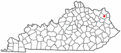
 Location of Grayson, Kentucky |
|
| Coordinates: 38°20′5″N 82°56′33″W / 38.33472°N 82.94250°WCoordinates: 38°20′5″N 82°56′33″W / 38.33472°N 82.94250°W | |
| Country | United States |
| State | Kentucky |
| County | Carter |
| Named for | landowner William Grayson |
| Government | |
| • Mayor | George Steel |
| Area | |
| • Total | 2.9 sq mi (7.5 km2) |
| • Land | 2.8 sq mi (7.3 km2) |
| • Water | 0.04 sq mi (0.1 km2) |
| Elevation | 633 ft (193 m) |
| Population (2010) | |
| • Total | 4,217 |
| • Density | 1,488/sq mi (574.7/km2) |
| Time zone | Eastern (EST) (UTC-5) |
| • Summer (DST) | EDT (UTC-4) |
| ZIP code | 41143 |
| Area code(s) | 606 |
| FIPS code | 21-32572 |
| GNIS feature ID | 0493221 |
| Website | graysonky |
Grayson is a city in and the county seat of Carter County, Kentucky, United States, in the state's northeastern region. The population was 4,217 at the 2010 census. Along with Carter County, the city is closely associated with the nearby Huntington-Ashland, WV-KY-OH Metropolitan Statistical Area being just 9 miles west of the M.S.A's western boundary. The city has grown in size substantially since the opening of Interstate 64 in 1975 through Carter County. Immediately afterwards, Grayson experienced several years of commercial sector growth to serve the Interstate 64 traffic. Since 1990, the city has also seen significant growth in the residential sector with the Interstate making for a faster trip to and from Ashland. Beginning in 1995, AA Highway terminates in Grayson making the city a gateway to the Huntington-Ashland urban area.
After the Revolutionary War, George Washington's aide-de-camp Col. William Grayson received a 70,000-acre (280 km2) tract of land for his service during the war from the state of Virginia. By 1838, a small portion of this tract was set aside for the development of a town named for him. Although Grayson had only five streets and eighty lots, it was established by the General Assembly on February 6, 1844, and it was incorporated on February 22, 1860.
Grayson is located in east-central Carter County at 38°20′5″N 82°56′33″W / 38.33472°N 82.94250°W (38.334738, -82.942368), along the Little Sandy River, a tributary of the Ohio River.
...
Wikipedia
