Grand Junction, CO Metropolitan Statistical Area
| Mesa County, Colorado | |
|---|---|

Mesa County Courthouse
|
|
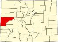
 Location in the U.S. state of Colorado |
|
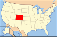
 Colorado's location in the U.S. |
|
| Founded | February 14, 1883 |
| Named for | mesas in the area |
| Seat | Grand Junction |
| Largest city | Grand Junction |
| Area | |
| • Total | 3,341 sq mi (8,653 km2) |
| • Land | 3,329 sq mi (8,622 km2) |
| • Water | 12 sq mi (31 km2), 0.4% |
| Population (est.) | |
| • (2015) | 148,513 |
| • Density | 44/sq mi (17/km²) |
| Congressional district | 3rd |
| Time zone | Mountain: UTC-7/-6 |
| Website | www |
Mesa County is one of the 64 counties of the U.S. state of Colorado. As of the 2010 census, the population was 146,723. The county seat is Grand Junction. The county was named for the many large mesas in the area, including Grand Mesa.
Mesa County comprises the Grand Junction, CO Metropolitan Statistical Area.
According to the U.S. Census Bureau, the county has a total area of 3,341 square miles (8,650 km2), of which 3,329 square miles (8,620 km2) is land and 12 square miles (31 km2) (0.4%) is water. It is the fourth-largest county by area in Colorado.
As of the census of 2010, there were 146,723 people, 58,095 households, and 38,593 families residing in the county. The population density was 44.1 people per square mile (17.23.1/km²). There were 62,644 housing units. Information that follows comes from the 2000 American Factfinder data: The racial makeup of the county was 92.34% White, 0.46% Black or African American, 0.91% Native American, 0.53% Asian, 0.10% Pacific Islander, 3.67% from other races, and 1.99% from two or more races. 10.02% of the population were Hispanic or Latino of any race.
...
Wikipedia
