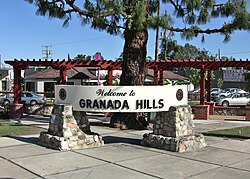
Granada Hills, Los Angeles, California
| Granada Hills | |
|---|---|
| Neighborhood of Los Angeles | |

A welcome sign at Chatsworth Street and Zelzah Avenue
|
|
| Motto: "The Valley's Most Neighborly Town" | |
 Boundaries of Granada Hills as drawn by the Los Angeles Times |
|
| Location within Los Angeles/San Fernando Valley | |
| Coordinates: 34°17′N 118°30′W / 34.283°N 118.500°W | |
| Elevation | 292 m (959 ft) |
| Time zone | PST (UTC-8) |
| • Summer (DST) | PDT (UTC-7) |
| Area code | 818 |
Granada Hills is a lightly populated, highly diverse and high-income neighborhood. It is a suburban residential community in the San Fernando Valley portion of the city of Los Angeles.
There is an active sports program and a range of city recreation centers. The neighborhood has fourteen public and seven private schools.
The community began as dairy farm and orchard known as the Sunshine Ranch which grew apricots, oranges, walnuts and beans. Vestiges of former citrus groves can still be seen in orange, lemon or grapefruit trees in many residential yards. In 1916, the San Fernando Valley's first oil well was drilled in what is now Granada Hills. The oil well was located at the northern tip of Zelzah Avenue. Granada Hills was founded in 1926 as "Granada;" the "Hills" portion of the name was added 15 years later.
Granada Hills is located at the foothills of the Santa Susana Mountains, north of the North Hills, Northridge, west of Mission Hills and Sylmar, and east of the Porter Ranch neighborhoods of Los Angeles. The Ronald Reagan Freeway–Route 118 runs along its southern side.
The 2000 U.S. census counted 50,535 residents in the 15.11-square neighborhood—or 3,344 people per square mile. In 2008, the city estimated that the population had increased to 53,998. In 2000 the median age for residents was 37,
The neighborhood is ethnically diverse and includes whites, 55.5%; Latinos, 20.6%; Asians, 16.3%; blacks, 3.4; and others, 4.2%. Korea (16.0%) and Mexico (13.8%) were the most common places of birth for 29.2% of the residents who were born abroad
...
Wikipedia

