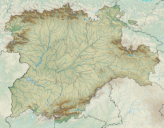
Gran Dolina
| Sierra de Atapuerca | |

Atapuerca Mountains panorama
|
|
| Location | near Atapuerca, Ibeas de Juarros |
|---|---|
| Region | Burgos, Castile and León |
| Coordinates | 42°22′0″N 3°31′20″W / 42.36667°N 3.52222°WCoordinates: 42°22′0″N 3°31′20″W / 42.36667°N 3.52222°W |
| History | |
| Periods | Paleolithic |
| Associated with | Homo antecessor, Homo heidelbergensis |
| Site notes | |
| Excavation dates | since 1964 |
| Archaeologists | Francisco Jordá Cerdá |
| Website | http://www.atapuerca.org/ |
 |
|
| UNESCO World Heritage Site | |
|---|---|
| Location |
Burgos Province, Spain |
| Coordinates | 42°21′00″N 3°31′10″W / 42.350092°N 3.519466°W |
| Includes |
Archaeological Site of Atapuerca |
| Criteria | iii, v |
| Reference | 989 |
| Inscription | 2000 (24th Session) |
|
[]
|
|
The Atapuerca Mountains (Spanish: Sierra de Atapuerca) is a karstic hill formation near the village of Atapuerca in Castile and León, northern Spain. In a still ongoing excavation campaign rich fossil deposits and stone tool assemblages were discovered in the complex of local caves that are attributed to the earliest known hominin residents in Western Europe. This "exceptional reserve of data" has been deposited during extensive Lower Paleolithic presence as the Atapuerca Mountains served as the preferred occupation site of Homo erectus, Homo antecessor (or Homo erectus antecessor) and Homo heidelbergensis communities. The earliest specimen yet unearthed and reliably dated confirm an age between 1.2 Million and 600,000 years. The site was designated a UNESCO World Heritage Site, under the name, Archaeological Site of Atapuerca.
Encompassing 284,119 ha (702,070 acres) the Atapuerca Mountains are a mid-altitude karstic range of small foothills around 1,080 m (3,540 ft) above sea level at the north-east corner of the Douro basin and to the south of the Cantabrian Mountains that run across northern Spain. Stretching alongside the Bureba corridor, a mountain pass that connects the Ebro river valley with the Mediterranean Sea and the Duero basin. This conjunction constitutes an ecotone, that is rich in species of both ecosystems. The mountain pass was part of an Roman causeway and the pilgrimage route of Saint James that is now traversed by the N-I and AP-1 highways. Situated strategically in between two major Drainage divides and near the mountain pass is assumed to have been supportive for the successful and prolonged hominid habitation.
...
Wikipedia


