Governor's Drive
| Governor's Drive | |
|---|---|
 |
|

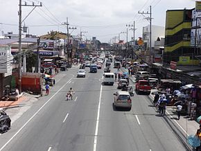
Governor's Drive in General Mariano Alvarez, Cavite
|
|
| Route information | |
| Length: | 58.3 km (36.2 mi) |
| Component highways: |
|
| Major junctions | |
| East end: | Soro-soro Bridge in Biñan, Laguna |
|
Aguinaldo Highway in Dasmariñas A. Soriano Highway in Naic |
|
| West end: | Palay-palay Junction in Ternate, Cavite |
| Location | |
| Major cities: | Biñan, Dasmariñas, Trece Martires, General Trias |
| Towns: | Carmona, General Mariano Alvarez, Tanza, Naic, Ternate |
| Highway system | |
|
Roads in the Philippines Highways | Expressways (list) |
|
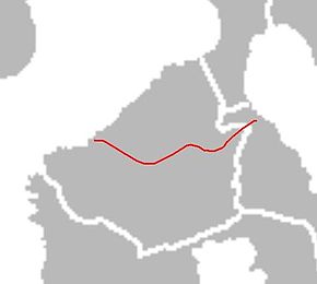
The Governor's Drive is a 2 to 9 lane, 58.3-kilometre (36.2 mi) network of roads and bridges traversing through the central cities and town in the province of Cavite, Philippines. It is the widest of the three major highways located in the province, the others are Aguinaldo Highway and A. Soriano Highway. The highway is part of a series of national highways, numbered 403 ,N405, N65, and N651
The eastern terminus of the highway is at Soro-soro bridge in Biñan, Laguna then it travels along Carmona, General Mariano Alvarez, Dasmariñas, General Trias, Trece Martires, southern Tanza, crosses A. Soriano Highway in Naic and ends at palay-palay junction in Ternate.
The highway is mostly concrete paved, while some other parts are currently being rehabilitated and being overlaid by asphalt.
Governor's Drive towards the provincial boundary with Laguna starts near SM City Dasmariñas at the Palapala intersection with Aguinaldo Highway. It then winds eastward, as it nears Manila Memorial Park, just on the side of the highway. It intersects Paliparan Road and then enters General Mariano Alvarez (GMA) through a bridge on the Dasmariñas-GMA boundary. It passes through GMA's town center before curving northeast at the GMA-Carmona boundary. At Carmona, it mostly runs through the town's industrial areas and bypasses the town center on the north. It soon crosses the South Luzon Expressway and enters Biñan, where it continues as General Malvar Street.
...
Wikipedia
