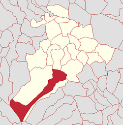
Gortahurk, Kilcronaghan civil parish
| Gortahurk | |
|---|---|
| Irish transcription(s) | |
| • Derivation: | Gort an Choirce |
| • Meaning: | "Field of the oats" |
 |
|
| Gortahurk shown within Northern Ireland | |
| Coordinates: 54°45′54″N 6°44′28″W / 54.765°N 6.741°WCoordinates: 54°45′54″N 6°44′28″W / 54.765°N 6.741°W | |
| Country | Northern Ireland |
| County | County Londonderry |
| Barony | Loughinsholin |
| Civil parish | Kilcronaghan |
| Plantation grant | Drapers Company |
| First recorded | 1609 |
| Government | |
| • Council | Mid Ulster District |
| • Ward | Tobermore |
| Area | |
| • Total | 351.93 ha (869.63 acres) |
| Irish grid ref | H8191 |
Gortahurk (locally [ˌɡɔrtəˈhɔrk] and [ˌɡɔrtneˈhərk], from Irish Gort an Choirce, meaning 'field of the oats') is a townland lying within the civil parish of Kilcronaghan, County Londonderry, Northern Ireland. It lies on the extreme south-west of the parish on the boundary with the parish of Ballynascreen. It is bounded by the townlands of Brackaghlislea, Coolsaragh, Drumard, Keenaght, Letteran, Straw Mountain, Tintagh, and Tullyroan. It was apportioned to the Drapers company.
The townland was part of Tobermore electoral ward of the former Magherafelt District Council, however in 1901 and 1926 it was part of Iniscarn District Electoral Division as part of the Draperstown dispensery (registrar's) district of Magherafelt Rural District. It was also part of the historic barony of Loughinsholin.
...
Wikipedia

