Goose Creek (Potomac River)
| Goose Creek | |
| Creek | |
|
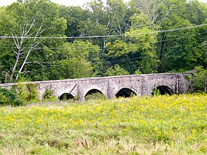
Goose Creek Bridge
|
|
| Country | United States |
|---|---|
| State | Virginia |
| Region | Loudoun County, Fauquier County |
| Source | |
| - location | Linden |
| - elevation | 1,040 ft (317 m) |
| - coordinates | 38°54′53″N 78°04′13″W / 38.9148335°N 78.0702756°W |
| Mouth | Potomac River |
| - location | Lansdowne |
| - elevation | 187 ft (57 m) |
| - coordinates | 39°06′04″N 77°28′38″W / 39.1012177°N 77.4772109°WCoordinates: 39°06′04″N 77°28′38″W / 39.1012177°N 77.4772109°W |
| Length | 55 mi (89 km) |
Goose Creek is a 53.9-mile-long (86.7 km)tributary of the Potomac River in Fauquier and Loudoun counties in northern Virginia. It comprises the principal drainage system for the Loudoun Valley.
Goose Creek rises at Manassas Gap on the Blue Ridge near Linden. The creek initially flows eastward down the mountain, falling 600 feet (180 m) in its first 10 miles (16 km). At Delaplane the creek levels out and turns in a northeasterly direction for another 10 miles, whereupon it passes under U.S. Route 50 and enters Loudoun County. Once in Loudoun, the creek continues in a northeastward direction for 15 miles (24 km) to the western foot of , where it turns to the north briefly, before reaching the confluence of the North Fork and then turning to the east and cutting through a gap in the mountain. On the east side of the mountain the creek again turns to northeast, joining with the Little River. The creek flows for 15 miles (24 km) through central Loudoun County, reaching the Potomac just east of Leesburg and south of Harrison Island. Goose Creek is partially dammed north of State Route 267. The dam may be portaged through the woods on the eastern shore.
The North Fork of Goose Creek rises at the east end of Sleeter Lake in Round Hill and flows 13.3 miles (21.4 km) in a southeastward direction, joining with the main branch in the water gap of the Catoctin Mountain.
...
Wikipedia

