Loudoun County, Virginia
| Loudoun County, Virginia | |||
|---|---|---|---|
| County | |||
| Loudoun County | |||

The Loudoun County Courthouse at Leesburg in May 2010
|
|||
|
|||
| Motto: "I Byde My Time" | |||
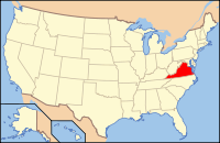
 Location in the U.S. state of Virginia |
|||
 Virginia's location in the U.S. |
|||
| Founded | 1757 | ||
| Named for | John Campbell, 4th Earl of Loudoun | ||
| Seat | Leesburg | ||
| Largest town | Leesburg | ||
| Area | |||
| • Total | 521 sq mi (1,349 km2) | ||
| • Land | 516 sq mi (1,336 km2) | ||
| • Water | 6 sq mi (16 km2), 1.1% | ||
| Population (est.) | |||
| • (2015) | 375,629 | ||
| • Density | 721/sq mi (278/km²) | ||
| Congressional district | 10th | ||
| Time zone | Eastern: UTC-5/-4 | ||
| Website | www |
||
Loudoun County (/ˈlaʊdən/ LOWD-ən) is a county in the Commonwealth of Virginia. In 2015, the population was estimated at 375,629, making it Virginia's third-most populous county. Loudoun's county seat is Leesburg. Loudoun County is part of the Washington–Arlington–Alexandria, DC–VA–MD–WV Metropolitan Statistical Area.
As of 2012[update], Loudoun County had a median household income of $117,876. Since 2008 the county has been ranked first in the United States in median household income among jurisdictions with a population of 65,000 or more.
Loudoun County was established in 1757 from Fairfax County. The county is named for John Campbell, Fourth Earl of Loudoun and Governor General of Virginia from 1756–59. Western settlement began in the 1720s and 1730s with Quakers, Scots-Irish, Germans and others moving south from Pennsylvania and Maryland and by English and African slaves moving upriver from Tidewater.
...
Wikipedia


